We managed to get onto a trip to Mostar today - despite being cancelled at 9pm the night before by a travel agent and having to call someone else at about 10... :) Thank you Dubrovnik Travel!
We stopped at a couple of places along the way to Mostar from Dubrovnik. The most interesting was called Pocitelj. It's in the Neretva river valley about 25km from Mostar. It existed in 1444 as a fortress supported by Hungary; Turks took it over in 1471 and it became an important part of the Ottoman Empire. A 17th century enclosing wall still exists. In its heyday, there was in the town an elementary school (mekteb), a secondary theological school (medresa) and also public baths (hammam) and an inn for travelers (han). The town was constructed right into a rocky mountainside overlooking a bend in the Neretva river. Its characteristic buildings are Ottoman style, with stone house, stone pathways and stone roofs. Lots of women and children selling dried and fresh fruit in these cute little papers twists.
Next we drove through the Neretva Valley, sometimes referred to as the "california of Herzegovina". The Neretva Valley is an area where tribes, nations and their armies have fought for dominance since the beginning of time. The trade routes have gone through Neretva Valley since prehistoric time. Those who controlled the valley and its many robbers and pirates could control the trade for all of present day Croatia and Bosnia-Herzegovina. The whole area is covered in little rivers all providing water for the thousands of tangerine trees, other fruit and vegatables, and increasingly grapes.
Into Mostar, where the devastation from the conflict in 1993 is evident everywhere. The original town is Ottoman, developed in the 15th and 16th century then again by the Austro-Hungarians in the 19th century. In the 1990s, most of the old town and the bridge were destroyed by shelling, and the scars can be seen in the empty buildings and the cemetery in which most of the deaths are 1993. It's so far away from Australia - we saw all of this on our tv screens but it's meaningless because we have no similar experiences. Anyway - the bridge was rebuilt using the same stone and the same methods as the original, and when the stones age will probably look like the Old Bridge - at the moment it's still pretty shiny!
The water in the river Neretva is greener than anything I've seen, apparently caused by a high concentration of limestone and very clear water. Sounds like it could be true - it is a very startling green!
We wandered through the Turkish old town, but after the Grand Bazaar in Istanbul most of the offerings looked over priced and a bit tacky. So off back 'home' to Dubrovnick - tomorrow we are off to Korcula - birthplace of Marco Polo!
Saturday, September 29, 2007
Friday, September 28, 2007
Dubrovnik, Croatia
Well we've been here for nearly a week now and I haven't done anything much other than put lots of photos onto the Picasa Web album. So here we go - a description of the old town. I'll attach labels to the photos rather than insert pictures into this post - much easier!
The most recognizable feature of the historic city of Dubrovnik are its intact city walls, which run uninterrupted for 1940 meters encircling the city. This complex structure, one of the most beautiful and strongest for system in the Mediterranean, consists of a series of forts, bastions, casemates, towers and detached forts.
The history of the fortifications goes back to the early Middle Ages. The earliest urban settlement upon the islet of Laus was protected with walls, and the fact that the city was able to resist the Saracens who besieged the city for 15months in the 9th century means that it was fortified well. The city first spread towards the uninhabited eastern part of the islet. The eastern section was included within the defence walls in the 9th and 10th century. When the sea channel separating the city from mainland was filled with earth in 11th century, the city merged with the settlement on land and soon a single wall was built around the area of the present-day city core. The whole city was enclosed in the 13th century, except for the Dominican monastery, which came under their protection not before the 14th century. The average thickness of the wall was 1.5 metres, and it was built of stone and lime. To increase the strength of the walls and ensure better defence, 15 square forts were built in the 14th century.
Extensive work was done on the walls towards the close of the 14th century, at the time of the final liberation from the Venetian supremacy. The design of the walls derives from 14th century, while the definite shape was fixed in the period referred to as the Golden Age of Dubrovnik, from the fall of Constantinople in 1453 until the devastating earthquake of 1667. The main wall on the landside is 4 to 6 metres thick, but narrower on the side facing the sea-1.5 to 3 metres thick. Its height reaches 25 meters in some places. An additional scarp wall as defence against artillery fire protects the wall on the landside. The irregular quadrilateral formed by the walls is protected at four prominent points by strong forts. The strong round Tower Minčeta is to the north, the port is protected by the detached Fortress Revelin in the east and by the big complex of the Fortress of Saint John in the southeast. The western entrance to the city protects the strong and beautiful tower Bokar. Powerful detached Fortress Lovrijenac also protects the western end of the city from danger from the sea and land. In additional to these strong and most prominent fortifications, the city walls are protected additionally by 2 round towers, 12 quadrilateral forts, 5 bastions and 2 corner towers, while the scarp wall is flanked by one large and 9 small semicircular bastions.
We enter through the Pile Gate, which is where the bus drops us off. Outside the gate is a fantastic view of the walls and one of the forts (Bokar), up on a rock outside the city walls. This fort's walls are much thinner on the side afcing the city so that if it was captured by the enemy the town could shell it easily! How's that for forward planning! The drawbridge was raised every night. There are two massive doors through the walls, an exterior door in a Renaissance style and a Gothic interior door topped by the statue of St Blaise, Dubrovnik's patron saint.
Straight ahead is the town's main street, Placa (pronounced "platsa") or Stradun, Dubrovnik's most illustrious feature, with the clock tower at the end.
Along the wide gleaming (limestone) street lined with shops and cafes, all Dubrovnik's processions take place. In front of the Pile Gate entrance is the circular Onofrio Fountain (named after its Neapolitan builder) built in the 15th century and with 16 carved masks, all with water spouts. Unlike the rest of Dalmatia, Dubrovnik citizens were not relegated to capturing rainwater; the fountain was connected by aqueduct with a spring 12km from town.
Opposite is the Franciscan Monastery with the restored sculpture of the Pieta over the entrance door. Inside is the Pharmacy dating from the 14th century and a gorgeous cloister also from the 14th century.
Next to the monastery is the 16th-century St Saviour Church, one of the few Renaissance structures to survive the earthquake of 1667.There are often concerts and exhibitions here.
Orlando's Column on the eastern end of Stradun was carved in 1417 and has been a popular meeting place for almost six centuries!
The Sponza Palace, Dubrovnik's Renaissance highlight is on one side f the square, and houses the State Archives.
Nearby is the ornate St Blaise's church, at the end of Stradun, dedicated to Dubrovnik's patron saint. Inside the lavish 18th-century church is a charming 15th-century statue of St Blaise who holds a scale model of Dubrovnik in his hand.
The Rector's Palace was built in the late 15th century for Dubrovnik's ruler, the elected Rector, who held office for one month on a revolving basis and was not allowed to leave the building during his term.
Across the square is Dubrovnik's baroque Cathedral. Built in the 18th century after an earthquake destroyed the original,the cathedral is still being explored after excavations revealed traces dating back to the 7th century.
The Ploce Gate also exits the city, and near here is the Dominican Monastery with a sober exterior that blends into Dubrovnik's walls. The art collection here centers on Dubrovnik's finest painters, mostly from the 15th and 16th centuries. There's also a lovely cloister dedicated to St Sebastian.
The view from Dubrovnik's walls is a fantastic way to get a feeling for the city. The walls are around 2km long, 25m high and up to 3m thick. As you look down at the town, you can see a patchwork of colours formed by the red-roofs. The shelling of 1991 left gaping holes Dubrovnik's distinctive terra cotta roofs. Some were repaired with tiles from a factory in Slovenia, some came from Agen, France but most were produced in northern Croatia.
Thursday, April 05, 2007
Jess' Graduation!
Jessica Graduated today with a Bachelor of Social Science degree. We are all very proud of her and her achievement!!!
 |
| Jessica's Graduation |
Sunday, March 11, 2007
Hannah's first birthday
mmm.. aren't first birthdays fun!
Today was my beautiful neice Hannah's first one, and what fun she had! Some photos in the albums...
Today was my beautiful neice Hannah's first one, and what fun she had! Some photos in the albums...
 |
| Hannah's Bithday |
Thursday, March 08, 2007
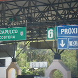
Acapulco
I know I have been very tardy in getting anything up here about Acapulco, but here it is!
We went to the Estrella D'Oro station on Saturday morning and I successfully, in Spanish, bought three return tickets to Acapulco - first class going down and in the special Diamante bus coming home! Ta Da!!!
We headed off on a very comfortable and uncrowded bus, and some 6 hours and innumerable stops at toll booths later, arrived in sunny Acapulco. The scenery on the way was nothing short of spectacular, and worth the trip by bus just to get to see sme more of Mexico out of the city.
In Acapulco, taxis were plentiful, but seemed to be very downmarket compared to DF.... lots and lots of VWs everywhere! We stayed at the Boca Chica Hotel, as recommended by the Lonely Planet Guide. This is not your high rise touristy hotel, and while it certainly lacked a little in the way of conveniences (no internet - GASP!), dodgy lighting and beds out of the Ark, it made up for these shortcomings by being quiet, green and lacking in tourists and spring breakers!
The first night we went to see the cliff divers... La Quebrada. MMM.. well maybe we were expecting something a little more spectacular - even though it was dark they didn't jump with the lit torches! We were very underwhelmed, although the ride there and back in a VW nearly took out breath away!
Other than this, we went to see the Fort and museum. For more than 250 years (1565-1815), trade between Spain (and thus a large part of Europe) and the 'Orient' was funneled through the port of Acapulco. Fuerte San Diego was built to protect the shipping and trade from English and Dutch pirates. The museum is really well done, and being Sunday, was free! Anyway after that we wandered to the Mask Museum, then down to the Artesans Market where we were badgered into buying things we didn't really want (now there's a surprise!) and then went back to the hotel for beer and swimming! At least the air conditioners in the rooms worked well, so we could cool down a bit. We also moved from the side with a view overlooking the island to the side with a view over the beach, as the room was bigger. The fold out bedllooked like it hadn't been used for a verrrry long time, so we skipped that and Jess and I bunked in together. Not ideal but only for a couple of days. The new side to the hotel gave us a great view over a family beach, where we sat for a couple of hours just watching the comings and goings.
The next few days we just took it pretty easy - swimming in the ocean until the jellyfish and the oil slick came in, and then into the pool!
 |
| Acapulco |
Thursday, March 01, 2007
Mexico City on foot
On Monday, we walked down to the Zocalo, via the LatinAmerica building. Now that I have felt several earth tremors I can appreciate the fact that this building was built with earthquakes in mind! More later but photos here...
Sunday, February 25, 2007
Teotihuacán
Next day we organised for 16 PISA people to go to the pyramids at Teotihuacan, the City of the Gods. Our driver from Thursday and a couple of his mates took us out there for a very reasonable price, so we drove out through kilometre after kilometre of suburbs until we got to the pyramids.
This is the site of the Sun and the Moon pyramids, and was Mexico's biggest ancient city and capital of the largest pre-hispanic empire. The city was developed in the early part of the first century AD, and the pyramid of the Sun was built by 150AD. At 2300m above sea level, it was always going to be a challenge to climb , but we all did it! Daniel then climbed to the top of the Pyramid of the Moon - twice - because on the first climb there was no one at the top that he knew to take his photo, so he came down and went back up!
The Avenue of the Dead was the main street of Teotihuacan. It ran for more than 2.5 km, beginning at the Moon Plaza to the north and extending beyond the Ciudadela and the Great Compound complexes to the south.
The avenue divided the city into two sections. Apartment compounds with pyramidal constructions were arranged on both sides of the avenue, often symetrically and sharing the same orientation. This highly planned city-layout suggests that the avenue may have been planned since its earliest phases of urbanization.
The main sector of the avenue was evidently the section between the Moon Pyramid and the Rio San Juan channel. This part of the avenue was lined with long platforms. Access to flanking residential zones was confined to masonry stairways with balustrades. The width of the avenue varies significantly between different sections, ranging from 40 to 95 metres. A large long channel under the floor of the avenue gathered rain water from neighboring architectural units and drained it into Rio San Juan.
As originally built, the Sun Pyramid was approximately 215 by 215 m at the base, and about 63 m high. It was significantly enlarged at least twice in later periods, resulting in a final size of 225 m along each side. The pyramid was located on the east side of the Avenue of the Dead in the northern half of the city. If the area of monumental construction between the Moon Pyramid and the San Juan Canal is regarded as the central zone of the city, the Sun Pyramid is located at its middle. In addition to its geographic centrality, the importance of the pyramid is indicated by a cave located under the structure, which was used for ritual purposes.
The Moon Pyramid is located at the northern end of the Avenue of the Dead, which was the main axis of the city. The pyramid, facing south, was built as the principal monument of the Moon Pyramid complex. The five-tiered platform was attached to the front of the Moon Pyramid. It is said that the present pyramid has interior structures within it.
The consolidated structures around the Moon Plaza demonstrate that the city was highly planned symmetrically and was integrated into the local geography. This may be realized by standing on the center line of the Avenue of the Dead, namely on the main axis of the city. The top of mountain Cerro Gordo dominating the background of the Moon Pyramid exactly coincides at a certain point of the avenue with the top of the pyramid; a pan-Mesoamerican notion that the pyramid represents a sacred mountain seems to have been an integral element of the city plan. The Avenue of the Dead begins at the Moon Plaza, which was surrounded by 15 pyramidal structures including the Moon Pyramid. The Quetzalpapalotl Palace lies immediately to the southwest of the Moon Plaza. Like the Main Plaza in the Ciudadela, the Moon Plaza seem to have been one of the main ritual precincts of the city.
Friday, February 23, 2007
Mexico City - first impressions
We flew into Mexico City late on Thursday night. From a distance you could see the lights of this enormous city, and as we got closer it became obvious just how big it was. I can't even remember clearing customs and immigration now, but I guess we did!
Found the hotel, in the Zona Rosa district, which at night is teeming with activity - not always savoury - have seen quite a few prostitutes of both genders! However it's not that far from downtown, and has its own charm.
First album of photos on the picasa web page is sights around Mexico City.
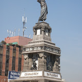
On the first day we hired a taxi driver who drove us around all day for 800 pesos for the four of us - about $20 each. He took us first to the main bullfighting ring in Mexico City - the Monumental Plaza Bull Ring, which holds about 110, 000 people and has fights on a Saturday. It looked hot and uncomfortable, and for those of us with other than tiny derrieres, the concrete seats looked narrow and constricting!!! Next stop was the Frida Kahlo house in Coyoacan. None of us knew much about Frida Kahlo before we went there - only what we had remembered for those of us who'd seen the Selma Hayek film! Frida Kahlo and Diego Rivera lived in this house during part of their marriage; they had a stormy relationship and divorced but came back together throughout their lives. They were both communists, and their paintings are passionate and strong and evocative of their times and lives. For example Frida had an affair with Trotsky. There's a lot more info here. The print I bought is shown and described here.
After this we went to Xochimilco...
Today this area, once on the edge of Mexico City, has been engulfed by the city. There are miles of these canals of which only 14 km, lined with farm homes and trees, dominated by the ahuejote, are navigable. The Gardens, besides still producing flowers, fruits and vegetables, have become a favourite spot where both locals and tourists come for a few hours to relax in the canals and enjoy their market culture.
Our trajinera (flat boat), like the 2,000 others that daily ply these canals for both work and pleasure, glided over the water with ease. Smaller trajineras, called chalupas came up alongside and continuously harangued us, offering drinks, food, handicrafts and much more - seemingly everything under the sun was for sale on these floating markets. Some were virtually floating kitchens, which offered a complete hot meal. Very touristy and yet not - there were many locals having parties on these boats, mariachi bands playing - it was all very festive and relaxing.
We went around the next day on the Turibus, which provided us with an overview of the main sights here. We also all got sunburnt, underestimating the strength of the sun as we sat in traffic for hour after hour after hour!
In the Zocalo we went to the archaelogical site of Tenochtitlan.
Found the hotel, in the Zona Rosa district, which at night is teeming with activity - not always savoury - have seen quite a few prostitutes of both genders! However it's not that far from downtown, and has its own charm.
First album of photos on the picasa web page is sights around Mexico City.
On the first day we hired a taxi driver who drove us around all day for 800 pesos for the four of us - about $20 each. He took us first to the main bullfighting ring in Mexico City - the Monumental Plaza Bull Ring, which holds about 110, 000 people and has fights on a Saturday. It looked hot and uncomfortable, and for those of us with other than tiny derrieres, the concrete seats looked narrow and constricting!!! Next stop was the Frida Kahlo house in Coyoacan. None of us knew much about Frida Kahlo before we went there - only what we had remembered for those of us who'd seen the Selma Hayek film! Frida Kahlo and Diego Rivera lived in this house during part of their marriage; they had a stormy relationship and divorced but came back together throughout their lives. They were both communists, and their paintings are passionate and strong and evocative of their times and lives. For example Frida had an affair with Trotsky. There's a lot more info here. The print I bought is shown and described here.
After this we went to Xochimilco...
In pre-Hispanic Mexico , in the valley where Mexico City stands was a lake called Lago Texcoco, which now has long been drained. The Aztecs, long before the Spanish came, dug a series of canals around the edge of the lake, and the mud they dug was heaped on the earth around the canals or on anchored reeds atop the water. These plots of land, appeared like floating islands called chinampas - hence, their name ‘floating gardens’.
To maintain soil fertility, farmers annually scraped muck from the canal bottom and applied decaying aquatic vegetation to the islands to prepare seed beds. The gardens became one of the most productive farming systems ever developed. By the time the Conquistadors came, the area of Xochimilco had become a rich agricultural district where many of the city's flowers, fruits and vegetables were grown.Today this area, once on the edge of Mexico City, has been engulfed by the city. There are miles of these canals of which only 14 km, lined with farm homes and trees, dominated by the ahuejote, are navigable. The Gardens, besides still producing flowers, fruits and vegetables, have become a favourite spot where both locals and tourists come for a few hours to relax in the canals and enjoy their market culture.
Our trajinera (flat boat), like the 2,000 others that daily ply these canals for both work and pleasure, glided over the water with ease. Smaller trajineras, called chalupas came up alongside and continuously harangued us, offering drinks, food, handicrafts and much more - seemingly everything under the sun was for sale on these floating markets. Some were virtually floating kitchens, which offered a complete hot meal. Very touristy and yet not - there were many locals having parties on these boats, mariachi bands playing - it was all very festive and relaxing.
We went around the next day on the Turibus, which provided us with an overview of the main sights here. We also all got sunburnt, underestimating the strength of the sun as we sat in traffic for hour after hour after hour!
In the Zocalo we went to the archaelogical site of Tenochtitlan.
The Aztecs built their capital city, called Tenochtitlan, in the center of enormous Lake Texcoco. The Aztecs believed they were the “chosen people” of Huitzilopochtli and did everything that he desired of them. During the fourteenth century, Huitzilopochtli told the Aztec chieftain that their new homeland would be on the island in Lake Toxcoco, and when they reached the island they were to look for an eagle eating a snake perched on a cactus growing from a rock or cave surrounded by water. This would be the location where they were to build their city and honor him. They found this location and began to build their city around the year 1325 AD.
The city of Tenochtitlan continued to grow, having an estimated population of 200,000. The city grew to a point where there was no more room for expansion on the island and they were forced to move out into the lake areas. The agricultural portion of this expansion was successful because of the invention of the chinampas or floating gardens. The floating gardens were constructed by bunching twigs together then stacking mud on top of the twigs. They were not anchored at first and could be towed until the plants roots anchored into the lake floor.
The Aztecs connected the island to the mainland by three causeways that ran next to dikes that were built to keep the fresh water of Lake Texcoco separate from other salty lakes of the area. The dikes also protected the agricultural chinampas. Canals ran between the chinampas; they were used to convey traffic through the city, including to and from the market of Tlatelolco.
The city flourished until the year 1521 when Hernandez Cortes and his Spanish army invaded and captured the city. The Spanish also had two other advantages: a lot of tactical skills on behalf of Cortes and smallpox, which devastated the Aztec population. After he defeated the Aztecs, Cortes destroyed most of the buildings that they had built and constructed the new Spanish city on top of the ruins, even using many of the original Aztec building materials in the new construction. He built his home on top of Montezuma’s palace and his cathedral on top of the Aztec temple. After a battle in 1692 the Spanish destroyed most of the art of the Aztecs in the name of Christianity. More info from Wikipedia here.
Thursday, February 08, 2007
Mum's birthday
Mum's 70th last weekend - we all had a lovely time and I think she did too!
Photos here:
Photos here:

Sunday, February 04, 2007
Birthdays and concerts galore
This has been a big week - Michael's birthday, Mum's birthday and Roger Waters all on February 1st and then Eric Clapton on the 3rd!
Both concerts were amazing - one for the opportunity to hear some of Waters' new stuff, and also (mainly) to hear the whole of Dark Side of the Moon played live. Different than the version with just Dave Gilmore, but just as awesome.
Eric Clapton - well what can you say - he is still the master, and Layla and Cocaine were fantastic!
A couple of photos... that's all!
Tuesday, January 02, 2007
Updates
Well.. I have now got a blogger web album, so I am going to change the way that I blog. Instead of the fomat I have been using up till now, I will post most of my pictures in albums at http://picasaweb.google.com.au/sue.thomson. I think it will be a whole lot easier than cutting and pasting into the blog page, and should make it neater as well. there's link from the blog site.
We've all had a relaxing Christmas - not blazing hot, but a pleasant 18 or so degrees. We had hail the day before that stayed on the ground and on cars - almost looked like a white Christmas!
Australia has throughly trounced the Poms and regained the Ashes - should never have lost them in the first place but it at least made this series a little interesting for a while....
Subscribe to:
Posts (Atom)