Well today was a blast, but i am totally shattered. It was so noisy outside my room last night that I didn't get to sleep until after midnight - there were still people yelling and kids playing in the street when I finally went out to it. Then at 2.35 I woke up, showered and got ready to go to Abu Simbel.
Security is certainly a lot tighter here than it was in Luxor for people venturing down near the Sudan border. All the vehicles in the convoy to Abu Simbel assembled at around 3.30 to be inspected by police, including under vehicle checks, then we all set off together.
Driving through the desert at night was amazing, all you could see was stars from one horizon to the other, and looking very different to our own night sky. I was teacher's pet, and got to sit up front with the driver, which I thought would be ok but my knees are caning now from being bent in one position for so long.
I slept part of the way, surprise surprise, and woke just as the stars were disappearing from the sky with the early rays of dawn. This also lit up the Sahara desert, through which we were probably driving for 3 hours - about 250km of it.
We arrived at Abu Simbel at dawn and it is just as spectacular as I thought it would be.
The twin temples were originally carved out of the mountainside during the reign of Pharoah Ramesses II in the 13th century BC, as a lasting monument to himself and his queen Nefertari, to commemorate his victory at the Battle of Kadesh, and to intimidate his Nubian neighbors.
The massive facade of the main temple is dominated by the four seated colossal statues of Ramesses. These familiar representations are of Ramesses II himself. Each statue, 20m high, is seated on a throne and wears the double crown of Upper and Lower Egypt. The whole temple is sculpted directly from the rock face, including all of the interior. The thrones are decorated on their sides with Nile gods symbolically uniting Egypt. Between the legs and on each of their sides stand smaller statues of members of the royal family, and beneath the giant sculptures are carved figures of bound captives.
The first hall inside the temple contains eight large statues of the king as Osiris, four on each side, which also serve as pillars to support the roof. The walls are decorated in relief with scenes showing the king in battle, including the Battle of Kalesh on the north, and Syrian, Libyan and Nubian wars on the south wall, and also presenting prisoners to the gods.
The sanctuary contains a small altar and in its rear niche are four statues. These cult images represent Ramesses II himself, and the three state gods of the New Kingdom: Ra-Horakhty, Ptah, and Amun-Ra. Before the statues rests a block upon which would have rested the sacred barque itself. The axis of the temple is arranged so that on two days of the year, February 22 and October 22, the rising sun shoots its rays through the entrance and halls until it finally illuminates the sanctuary statues.
To the north of the main temple a smaller temple was built in honor of Ramesses’ great wife, Nefertari, and the goddess Hathor. As with Ramesses’ own temple, the cliff face was cut back to resemble sloping walls of a pylon. Six colossal standing figures 11m high, four of Ramesses and two of Nefertari, were cut from the rock face, along with smaller figures of the royal family. An inscription over the entrance reads "Ramesses II, he has made a temple, excavated in the mountain, of eternal workmanship, for the chief queen Nefertari, beloved of Mu, in Nubia, forever and ever, Nefertari for whose sake the very sun does shine."
As a side note: Ramses II had a harem of wives, although his special wife was Nefertari, and more than 150 children have been identified by name as his - presumably there are more!
So totally stuffed, I have no energy left to look at anything else. I am resting for the afternoon before braving the souk tonight.
Saturday, February 07, 2009

Day 4 - Fun with Egypt Rail!
I had bought a ticket for the train to Aswan leaving at 9.30am, one of only three trains during the day that tourists are allowed to travel on. The train arrived at 12.30. I'll never complain about Connex again!
I had a first class ticket, carriage 1, and had met up with a couple of Brits while waiting who were in carriage 2. When the train finally arrived we all got put into the same carriage anyway and sat with ewach other, which was very nice. It's all very well travelling in a Muslim country as a single female - whatever your age or marital status the men feel free to propose to you or treat you strangely. Safety in numbers was a welcome respite, especially with a man!
I'm glad I booked first class, would hate to see second! Anyway it was ok and there was an armed guard in the carriage so we felt pretty safe!
It took 3 hours to get here to Aswan, so we arived much later than I thought but at least I knew I had a bed for the night. The train was OK until we got about half an hour out of Aswan (10 minutes we were told by the official person who wandered through) and we basically crept metre by metre into the sattion. Ye Gods I was tired of this!
Got a taxi to my hotel with the Brits - not enough room in the boot so my suitcase got heaved onto the packrack - no tying it down so I had my fingers crossed, but we arrived safely and I found a very nice man who carried the heavy bag up the flight of stairs and then REFUSED to take any money for it!! In the land of baksheesh this is unbelievable!
My room is't big enough to swing a cat in and the bathroom is tiny but it looks clean and there's a double bed. It's noisy as hell outside but I am hoping that it quiets down, as I will have to be in bed early tonight as I have booked to go to Abu Simbel at 3.15am. We have to go in a convoy with police escort, which all sounds rather dramatic, but then we are a lot closer to the Sudan border here.
The hotel is absolutely full of Egyptian families on holiday with their children - the women all smile at me and say hello, so it feels quite comfortable.
I am off now to try and find the restaurant in Souk street that was recommended to me. Egytpian food - real Egyptian food if you are strong enough, he told me. God knows what that means but I must remember to take all my drugs with me tomorrow just in case!
I had a first class ticket, carriage 1, and had met up with a couple of Brits while waiting who were in carriage 2. When the train finally arrived we all got put into the same carriage anyway and sat with ewach other, which was very nice. It's all very well travelling in a Muslim country as a single female - whatever your age or marital status the men feel free to propose to you or treat you strangely. Safety in numbers was a welcome respite, especially with a man!
I'm glad I booked first class, would hate to see second! Anyway it was ok and there was an armed guard in the carriage so we felt pretty safe!
It took 3 hours to get here to Aswan, so we arived much later than I thought but at least I knew I had a bed for the night. The train was OK until we got about half an hour out of Aswan (10 minutes we were told by the official person who wandered through) and we basically crept metre by metre into the sattion. Ye Gods I was tired of this!
Got a taxi to my hotel with the Brits - not enough room in the boot so my suitcase got heaved onto the packrack - no tying it down so I had my fingers crossed, but we arrived safely and I found a very nice man who carried the heavy bag up the flight of stairs and then REFUSED to take any money for it!! In the land of baksheesh this is unbelievable!
My room is't big enough to swing a cat in and the bathroom is tiny but it looks clean and there's a double bed. It's noisy as hell outside but I am hoping that it quiets down, as I will have to be in bed early tonight as I have booked to go to Abu Simbel at 3.15am. We have to go in a convoy with police escort, which all sounds rather dramatic, but then we are a lot closer to the Sudan border here.
The hotel is absolutely full of Egyptian families on holiday with their children - the women all smile at me and say hello, so it feels quite comfortable.
I am off now to try and find the restaurant in Souk street that was recommended to me. Egytpian food - real Egyptian food if you are strong enough, he told me. God knows what that means but I must remember to take all my drugs with me tomorrow just in case!
Thursday, February 05, 2009
Day 3 - The West Bank ...
They changed the muezzin for the first call to prayer. This one was very soothing and almost musical. Very pleasant way to wake up even at that unearthly time, and I slept through the next one!
Met Diaa at the ferry and crossed to the West Bank, where I met his cousin Sayed and we headed off to the Valley of the Kings.
The Valley lies in a deep ravine of the limestone hills near Qurna, and is sacred to the local goddess Mertseger (she who loves silence - hah!) and to Hathor. The valley is surrounded by high cliffs, dominated by a pyramid shaped peak.
There have been 62 tombs found in the Valley, and they are still finding more I believe, but only a few are open to the public at any one time. Basically you get a ticket for three tombs, and no photos allowed inside the tombs (unless, I found out later, you bribe someone! This IS Egypt after all!)
I had decided that I would go to the tomb of Tuthmosis III first, as it was furthest away, but honestly didn't realise how hard it would be! It was dug 30m above the ground in an effort to foil thieves (in vain) and so you climb up a 30m metal staircase then descend into the tomb. Oh yes that means you have to climb back up, which in the heat was exhausting. Tuthmosis III was buried in about 1490 BC, and was taught by Hatshepsut before he asserted sole rule and created an Egyptian empire extending from Syria to Nubia. The site was only discovered in 1998!
Inside the tomb was quite fabulous - with the walls painted portraying the Book of Amduat - That which is in the Underworld, as well as a blue ceiling with yellow stars. There is a red granite sarcophagus inside.
Second stop was the to KV14, the Tomb of Queen Tawsert and Sethnakht. This was originally built for the queen of Seti II, Tawsert, but was appropriated by the 20th Dynasty pharoah Sethnakht after he ran into difficulties digging his own tomb! Third stop was the tomb of Ramses IV, which had some fabulously painted scenes from the Book of the Dead.
Next stop was Hatshepsut's Temple at Deir al-Bahri. What a breathtaking sight - partly cut into the sheer rock behind it and rising in tiers up out of the desert. The columns of the portico around the upper terrqce were decorated with Osiride statues of Hatshepsut, characteristically represented as a male king with a beard! She was the fifth pharoah of the 18th dynasty, and had a long, prosperous and largely peaceful reign. The temple is part of a larger complex, now largely lost, which incorporate temples for Tuthmosos III and Montuhotep II, and in front were planted myrrh trees and a row of sphinxes that led to the Temple of Karnak.
Last stop before I fell exhausted and starving was Medinat Habu, which is dominatd by the mortuary temple of Ramses III, modelled on Ramses II's temple at the Ramesseum (coming up soon!). during invasions of Egypt in the 20th Dynasty, the entire population of Thebes took refuge within its walls.
so endeth the third day, tomorrow off to Aswan for Abu Simbel.
Met Diaa at the ferry and crossed to the West Bank, where I met his cousin Sayed and we headed off to the Valley of the Kings.
The Valley lies in a deep ravine of the limestone hills near Qurna, and is sacred to the local goddess Mertseger (she who loves silence - hah!) and to Hathor. The valley is surrounded by high cliffs, dominated by a pyramid shaped peak.
There have been 62 tombs found in the Valley, and they are still finding more I believe, but only a few are open to the public at any one time. Basically you get a ticket for three tombs, and no photos allowed inside the tombs (unless, I found out later, you bribe someone! This IS Egypt after all!)
I had decided that I would go to the tomb of Tuthmosis III first, as it was furthest away, but honestly didn't realise how hard it would be! It was dug 30m above the ground in an effort to foil thieves (in vain) and so you climb up a 30m metal staircase then descend into the tomb. Oh yes that means you have to climb back up, which in the heat was exhausting. Tuthmosis III was buried in about 1490 BC, and was taught by Hatshepsut before he asserted sole rule and created an Egyptian empire extending from Syria to Nubia. The site was only discovered in 1998!
Inside the tomb was quite fabulous - with the walls painted portraying the Book of Amduat - That which is in the Underworld, as well as a blue ceiling with yellow stars. There is a red granite sarcophagus inside.
Second stop was the to KV14, the Tomb of Queen Tawsert and Sethnakht. This was originally built for the queen of Seti II, Tawsert, but was appropriated by the 20th Dynasty pharoah Sethnakht after he ran into difficulties digging his own tomb! Third stop was the tomb of Ramses IV, which had some fabulously painted scenes from the Book of the Dead.
Next stop was Hatshepsut's Temple at Deir al-Bahri. What a breathtaking sight - partly cut into the sheer rock behind it and rising in tiers up out of the desert. The columns of the portico around the upper terrqce were decorated with Osiride statues of Hatshepsut, characteristically represented as a male king with a beard! She was the fifth pharoah of the 18th dynasty, and had a long, prosperous and largely peaceful reign. The temple is part of a larger complex, now largely lost, which incorporate temples for Tuthmosos III and Montuhotep II, and in front were planted myrrh trees and a row of sphinxes that led to the Temple of Karnak.
Last stop before I fell exhausted and starving was Medinat Habu, which is dominatd by the mortuary temple of Ramses III, modelled on Ramses II's temple at the Ramesseum (coming up soon!). during invasions of Egypt in the 20th Dynasty, the entire population of Thebes took refuge within its walls.
The rampart itself was a large gateway of distinctive design modeled after a migdol or fortress. Fronted by guard-houses, the gateway sides are decorated with images of the king trampling enemies of Egypt, and sculpted figures of the monarch standing atop the heads of captives project from the walls. A large relief representation of the god Ptah was here, having the power to transmit the prayers of those unable to enter the temple to the great god Amun within.
The upper rooms of the gate-house functioned as a kind of royal retreat or harem, its walls graced with representations of the king relaxing with young women. Perhaps it was here that the attempted assassination of Ramesses III took place. Its massive outer pylons are the most imposing of any temple in Egypt, and are decorated with colossal images of the king destroying captured enemies before the gods. The temple’s outer walls also depict important battle and victory scenes over the Libyans and Sea Peoples. These scenes are continued into the first court.
On the northern side of this court were large statues of the king as Osiris, and on the south a columned portico with the window of appearances in which the king stood or sat during formal ceremonies and festivities. The large statues of the second court were destroyed in the early Christian era when the area was converted into a church. Relief scenes here still in good condition depict rituals connected with the god Min, and on the rear wall of the portico, a procession of the king’s numerous sons and daughters.
Off to the left of the second Hypostyle Hall is the funerary chamber of Ramesses III, with the god Thoth shown inscribing the king’s name on the sacred tree of Heliopolis.
The focus of the main axis of the temple is the sanctuary of Amun. It was once finished in electrum with a doorway of gold and the doors themselves of copper inlaid with precious stones. Behind the sanctuary lies a false door for Amun-Ra united with eternity, namely, the divine form of Ramesses III.
On the southeastern side of the temple are the remains of a royal palace, which was probably much smaller than the king’s main residence, serving as a spiritual palace as well as the occasional royal visits. It was originally decorated with glazed tiles, and its bathrooms were lined with limestone to protect the mud-brick. From the palace, the king could enter the first court, or peruse it from a window of appearances on its southern side.
To the right of the complex entrance stands the earliest section of the complex, the so-called "Small Temple", founded in the 18th Dynasty, and repeatedly expanded and usurped under later dynasties. It stood on one of the most sacred spots in all Egypt, the primeval hill which first rose out of the receding waters of Chaos. An inscription describes it as the burial place of the four primal pairs of gods.
A lovely side piece to this place: Ramses would pay his soldiers after a battle according to how many men they had killed , so they would brutally chop off the hands or penises of their enemies, these grisly trophies would ensure their reward from the king. Rows of scribes calmly and methodically counted and recorded these grisly spoils of war, from the baskets of blood dripping hands that are piled high waiting to be emptied and then counted. All shown on the walls!
Lunch was at Mohammed's restaurant, a nice meal with a lovely salad of fresh tomatoes that I hope doesn't make me sick, accompanied by his two cats, Hilary Clinton and Barrack Obama. Both reasonably healthy looking for Egytpian cats, and Hilary had one blue eye and one brown, very striking!
After lunch I had pretty much exhausted all my reserves, so I decided to visit a couple of the Tombs of the Nobles and the Ramusseum and then call it quits for the day.
The Ramusseum is the mortuary temple of Ramses II, and lies largely in ruins. Ramses II built his fabulous mortuary temple on the site of Seti I's ruined temple, where he identified himself with the local form of the God, Amun. It was begun early in his reign, and took twenty years to complete. It was described by Diodorus as the 'tomb of Ozymandia' which inspired a verse by the great poet, Percy Bysshe Shelley. Diodorus also mentions a 'sacred library' at the temple, though modern Egypologists have found no evidence to support this claim. This great temple reportedly rivaled the wonders of the temple at Abu Simbel, and is very similar both in reliefs and architecture to Ramesses III's mortuary temple at Medinet Habu. However, Ramesses built the temple too close to the Nile and the flood waters took their toll. Only a single colonnade remains of the First Courtyard.
The main building where the funerary cult of the king was celebrated was a typical stone-built New Kingdom temple. It consisting of two successive courtyards with pylon entrances, and a hypostyle hall with surrounding annexes. The pylons, some of the oldest examples of such structures, are decorated with scenes from the Battle of Kadesh. These scenes show Ramesses fighting the Hittites. He is shownin a heroic counterattack, standing in his chariot firing arrows with deadly precision at the fleeing Hittites.
The second court is much more complete then the first. It is flaked both east and west by pillarered porticos with Osiride statues of Ramesses. These statues show Ramesses being summoned to rebirth in anew life, tightly wrapped in a shroud with his arms crossed, holding his scepters.
The hypostyle hall has a well preserved ceiling in the center. It was lit by traceried windows. Behind the facade on the interior (south) wall is a scene showing the capture of the Syrian fortress of Dapur, while across the hall at the far end of the west wall, Ramesses Ii si depicted receiving his scepters from Amun-Re. The Hall led to a room for the sacred bark (a ritual boat) and sanctuary.
In front of the ruins is the base of the colossus of Ramesses that once stood 17m high. The statue would have weighed more than 1,000 tons and was bought from Aswan in one piece. On the granite colossus's shoulder is an inscription describing Ramesses as the "sun of Princes". The statue fell into the Second Court and the head and torso remain there, but the other broken pieces are in museums all over the world. It is this statue that Shelly's poem alludes to:
So onto the Tombs of the Nobles, which was OK but I was just about completely tombed out by now, then off home stopping at the Colossi of Memnon on the way. These two enthroned statues of Amenhotep III tower 18m above the desert, and originally guarded his mortuary temple - reputedly the largest in Egypt but now gone...I met a traveller from an antique land
Who Said: Two vast and trunkless legs of stone
Stand in the desert, Near them, on the sand,
Half sunk, a shattered visage lies, whose frown,
And wrinkled lip, and sneer of cold command,
Tell that its sculptor well those passions read
Which yet survive, stamped on these lifeless things,
The hand that mocked them, and the heart that fed.
And on the pedestal these words appear:
"My name is Ozymandias, king of kings;
Look on my work, ye Might, and despair!?
Nothing beside remains, Round the decay
Of that colossal wreck, boundless and bare,
The lone and leve sand stretch far away.
so endeth the third day, tomorrow off to Aswan for Abu Simbel.
Wednesday, February 04, 2009
Day 2 - Karnak and Luxor Temples, plus a felucca on the Nile!
Day 2.
Slept in a little this morning and didn’t get moving until about 9am, even after being woken by the first call to prayer. Walked to the railway station through the local neighbourhood, with kids playing in the street, women washing and cleaning and men sitting around doing sweet FA. Well some of them were working, there were many carts pulled by donkeys moving through the back streets – it’s quite rural here in many ways. The donkeys all looked skinny and were well and truly whipped when they carried on, which some of them were certainly doing. There are lots of cats everywhere, skinny mangy dirty looking things, foraging through rubbish piles and fighting all through the night.
Sending his young assistant scurrying up the mast like a little monkey to tie up the sail, the two of them got out some primitive looking oars and rowed us back. Diaa's 'cousin' was apparently available to chauffer me around in his new taxi, with airconditioning, if I wanted to do the West Bank tomorrow. I did, and so we made the deal.
Slept in a little this morning and didn’t get moving until about 9am, even after being woken by the first call to prayer. Walked to the railway station through the local neighbourhood, with kids playing in the street, women washing and cleaning and men sitting around doing sweet FA. Well some of them were working, there were many carts pulled by donkeys moving through the back streets – it’s quite rural here in many ways. The donkeys all looked skinny and were well and truly whipped when they carried on, which some of them were certainly doing. There are lots of cats everywhere, skinny mangy dirty looking things, foraging through rubbish piles and fighting all through the night.
Caught a taxi from the station to Karnak Temple. When I got there, there were a million tour buses lined up, which was a little disheartening, however they all seem to get about an hour at each place then head off, so I knew it was just a matter of waiting them out. The German tourists were probably the worst, pushing and shoving with little respect for anyone else.
It was already hot, and I had left my hat behind, not thinking I would need it. Wrong. Lucky I had sunblock and water, but it was a hard slog.
I won’t bore you with all the details about Karnak as it is a HUGE site. It’s Egypt’s most important Pharaonic site, and the temples were built over a 1300 year period and cover about 100 acres. The largest temple is the Temple of Amun, the king of the gods. It started in the 11th Dynasty as a modest sized temple, but it’s scale grew as pharaoh after pharaoh added to it and changed the existing buildings. During the 19th Dynasty around 80,000 men worked in the temple as labourers, guards, priests and servants. The temple lay buried under sand for 1,000 years before they started excavation work in the mid 19th century. This is still continuing. I suppose this is one of the amazing things about Egypt – what else is out there but can’t be dug up because there are towns, cities or mosques built on top of them?
The entrance to the temple is flanked by rows of ram-headed sphinxes, which once led to the Nile. Inside is the Colossus of Ramses II, with one of his daughters at his feet, in front of the entrance to the Great Hypostyle Hall. This huge hall was supported by 134 gigantic columns, all with stunning reliefs. The huge stone lintels are still largely in place, and it is almost impossible to imagine what it looked like with a roof on.
Past this, and past a couple of obelisks, granite statues, pylons and the Great Festival Temple, you emerge at the end of the complex to find a rather grotty looking sacred lake. Priests used to purify themselves in this before performing rituals in the Temple, but I doubt anyone would go anywhere near it nowadays. It seems a pity when you have this absolutely magnificent complex, to not drain the lake and clean it up.
I wandered away from the Germans and went around to an area which seemed to be closed off, until the armed guide, after asking me if I was from Sweden and being told no, Australia, said I could go have a look. There were a couple of surveyors around there but blessedly no tourists! The ninth pylon was another spectacular sight, even though I really have no idea what was on it!
Back into the maze of courtyards I went through the Temples of Khonsu and Opet and then out into the heat of midday. Even the guys selling papyrus and stone scarabs only had a desultory go at hassling me! I walked out and decided I didn’t feel like walking the 2 km back to the Luxor Temple, so took a calesh, a horse-drawn cart, for about $1.50 Australian. Bargain!
Luxor Temple.
Luxor Temple certainly dominates the town of Luxor. The temple was dedicated to the Thebans Amun, Mut and Khonsu, and was largely completed by the 18th dynasty pharaoh Amenhotep III and added to during the reign of Ramses II in the 19th dynasty. It was later modified by other rulers, including Alexander the Great, but it’s design remained coherent, the opposite of Karnk. In the 3rd century AD the site was occupied by a Roman camp and thereafter abandoned, and over the years it was engulfed in sand and silt and a town grew up over it. In 1881 it was rediscovered and the town moved, all but the 13th century mosque which still stands within the walls, the height of it showing the height of the town.
The temple is approached by a row of sphinxes which once stretched all the way from Luxor to Karnak, 2 km away. The enormous first pylon is decorated with scenes from Ramses II's victory over the Hittites int he battle of Qadesh. There are two enormous seated colossi of Ramses II and a 25m high pink granite obelisk, which is one of a pair - the other donated to the French people early in the 19th century which now stands in the Place de la Concorde in Paris.
Inside a double row of papyrus bud columns encircles the court, interspersed with huge standing colossi of Ramses II. More giant black granite statues of Ramses II guard the entrance to the original part of the temple, which begins with the Colonnade of Amenhotep III, with its avenue of 14 columns. The walls here were embellinshed during the reign of Tutenkamun and show the annual Opet festival, when the images of Amun, Mut and Khonsu were taken in procession from Karnak to Luxor.
After the collonade is the fantastic Court of Amenhotep III, which has double rows of towering papyrus columns, supposedly the best preserved and most elegant in t he temple. On the southern side of the court is a hypostyle hall (hypostyle is a flat ceiling supported by columns), with 32 papyrus columns in four rows of eight, bearing the cartouches (an oblong enclosure with a horizontal line at one end, indicating that the text enclosed is a royal name) of Ramses II, Ramses IV, Ramses VI and Seti I.
More,more, more.. too much to do here, and probably for you to read!
After wandering around here for a couple of hours, and just sitting in one of the courtyards escaping the heat and drinking in the atmosphere, I wandered out onto the Corniche de Nile, the main street along the Nile. After the peace of the Temple, I was assaulted by dozens of men trying to get me to do a felucca ride. I beat most of them off, agreeing to come back at 4pm for a felucca ride with a young man called Diaa, and found a reasonable looking place to sit and watch the Nile and have a quiet beer and some felafel.
Four found Diaa waiting for me at the stairs to take me to his felucca, a small sailing boat. We spent about 45 mins sailing up the Nile until the sun had set, and the wind dropped completely. During this time we just watched the world go by along the banks; a soccer match int he dust, kids swimming, camels waiting to be ridden (little ones, not like ours!), and being assailed by young children, some as young as about 3 and none older than about 8, rowing very dodgy looking boats up and asking us for money!Sending his young assistant scurrying up the mast like a little monkey to tie up the sail, the two of them got out some primitive looking oars and rowed us back. Diaa's 'cousin' was apparently available to chauffer me around in his new taxi, with airconditioning, if I wanted to do the West Bank tomorrow. I did, and so we made the deal.
Tuesday, February 03, 2009
Egypt Day 1 - Abydos and Dendara Temples
NOTE: I'm not going to post any photos here - too much hassle. They're on my picasaweb page, link on the left.
Day 1
After finally getting into Luxor at about 8pm on Monday night, decided to hit the ground running and go on a day trip to Abydos and Dendara on the first day. Always a great way to avoid any jet lag – just keep moving! I slept like a log, but was woken by the first call to prayer at 4.45 am, then the second at god knows what time. We left at 8am on the minibus – just three of us and our guide and driver, and drove for three hours through huge agricultural areas of sugar cane, tomatoes, cabbages and other veggies, with the ‘convoy’. This is to protect tourists, and basically was a loose group of tour buses with police escort travelling through the countryside. This is the only way that tourists are allowed to travel out of the cities in Egypt now.
It was nice travelling in the rural areas, through little villages and towns, with donkey drawn carts and just donkeys loaded with freshly cut sugar cane charging along the streets. Whenever we stopped anywhere, even to wait for a train to cross, local children would rush over to the bus and smile and wave to us. They all seemed to want pens, so I wish I had thought ahead and packed a couple of boxes of them. They are all filthy dirty, as I guess you would expect given that they run around in the dust of the desert all day!
Before I get into the temples we saw, you need to know the major gods to know where everything fits. Some of them were:
Anubis, the jackel-headed god of embalmers. Hathor,the goddess of love, pleasure and beauty, Horus, the falcon-headed god closely identified with each pharaoh, Isis, the goddess of magic, Maat, goddess of truth and balance, Nut, goddess of the sky, Osiris, god of the underworld, Ptah, creator god and patron of craftsmen, Sekhmet, lioness goddess of destruction, Oh and then there’s Ra-Harakhty – who was the combination of the sky god Horus and the sun god Ra, whose right eye was the sun and left eye the moon.Abydos. According to my guide this is the cult centre of Osiris, god of the dead, and was regarded as the holiest of Egyptian towns in Pharaonic times. There were a large group of women all in white there who were on some sort of spiritual tour through the middle east, but not many other tourists.
Tradition has it that Osiris, or at least his head, was laid to rest here after being murdered by his brother Seth and his mutilated body strewn over the countryside. All ancient Egyptians tried to make a pilgrimage to the town or be buried there.
This used to be a huge walled town, but what is left is the 19th Dynasty Cenotaph Temple of Seti I. This was built during Seti I’s reign between 1294 and 1279 BC, and is one of the most intact temples in Egypt – still having a roof helps. It’s constructed of white limestone and has a lot of figures that have retained their original colour. After the death of his father, Ramses II built his own temple to the north of Seti I’s temple, but only part of this is intact. Outside there is lots of rubbish, although we were told that they did clean it up every day – the argument is that it blows in off the desert although from God knows where. However that’s one of the most striking things that you notice in Egypt – the rubbish everywhere. There is plastic everywhere – despite the fact that they burn much of their domestic rubbish, plastic included, which means there is a particularly noxious smoke around for much of the time, mixed at this time of the year with smoke from the burning off of the sugar cane.
So back to Abydos. Some of the scenes inside show Seti I with the gods Horus and Osiris. Inside the temple there are seven chapels dedicated to a deified Seti I, and the gods Ptuh, Ra-Harakhty, Amun, Osiris, Isis and Horus. Each of the chapels contained the barque of the relevant god and was served daily by the high priests. Behind the temple Seti had built the Osireon (tomb of Osiris) from huge blocks of granite from Aswan, but much of this is under water and again with lots of rubbish around.
One of the things that Mara had told us to look for, which isn’t mentioned in the guidebooks, was a lintel on which are some very interesting carvings – one looks like a helicopter, one a racing car, one a submarine, and another a space ship – to me it looked like the Enterprise! Maybe Eric Von Daniken was right after all …
Inside the first chamber it was very Indiana Jones-ish, with beams of light coming through the roof onto the pillars. It was very beautiful and peaceful, particularly when the Japanese tourists had left! The chapels are quite stunning, with exquisite relief carvings.
After exploring Abydos we set off on the drive back to Dendara Temple. We stopped on the way for the driver to buy fresh molasses from the side of the road, and for a treat for those that wanted to try it, molasses cones, which were boiled molasses put into cones for shape until they solidified, making these sort of brown sugar toffee cups. The American couple with me tried them and said they were delicious, but I didn’t think it would be a great idea for me!
We arrived at Dendara late in the day – which was unfortunate as we were rushed around it quite a bit.
Dendara is where Hathor supposedly gave birth to Horus’s child, the god Ihy, and was Hathor’s cut centre from pre-Dynastic times. The temple was buried in sand until the 19th century, and so has remained pretty intact. The current temple is Greco-Roman but it’s desogn is that of a typical Pharaonic temple, with a series of large hypostyle halls leading to a dark sanctuary, surrounded by a maze of store rooms, chapels and crypts. There are also two birthing houses and a Coptic basiclica on the grounds.
Inside it was glorious. On the pylons outside are reliefs showing the Roman emperors Tiberius and Claudius making offerings to Hathor and Horus, and inside the columns are all topped with Hathor heads. There is an astronomical ceiling which is still beautifully coloured , with zodiac signs and the sun god Ra sailing his sacred barque across the sky. Inside the temple we went down into a tiny crypt, which was a little claustrophobic but well worth it for the stunning scenes along the walls. Then up into the sunlight again to the New Year chapel, where rituals were performed before taking Hathor’s statue up to the roof. On the ceiling are reliefs showing Nut giving birth to the sun.
From there we went up onto the roof of the chapel, where an open-air chapel was where the statues were exposed to the sunlight once a year to be revitalized by the sun. We went into another crypt on the roof in which the reliefs showed what looked like the Ark of the Covenant. Will have to check this one!
From there we descended a long, beautifully decorated staircase in which the stairs had almost completely worn out from centuries of use, and back into the temple.
Outside on the west wall were other huge reliefs showing offerings to Hathor, and on the south wall is a large one showing Cleopatra making offerings to Hathor with her so by Julius Caesar, Caesarion, standing in front of her burning incense. Next to this is the Temple of Isis, a relatively new addition, built by the Roman emperor Augustus between 30 BC and 14 AD.
So that was the first day! We got back into town at about 6.30, after the curfew but we got checked back off and allowed in.
Sunday, February 01, 2009
Off to Egypt
Well here we go again for another year.
First part of this trip, which I will try FAITHFULLY to blog, is to Egypt, in particular to Luxor and Aswan. I leave at 5pm this afternoon, fly to Singapore, then Frankfurt, Cairo, and finally to Luxor. I'll be there at about 8pm n Monday, Egypt time.
After a week in southern Egypt I head to Sharm El Sheikh, in Southern Sinai, for a meeting, then on to Brussels, Belgium for a week. Will be home around Feb 23rd.
So that's it for now... I'll post whenever I can.
Cheers
Sue
First part of this trip, which I will try FAITHFULLY to blog, is to Egypt, in particular to Luxor and Aswan. I leave at 5pm this afternoon, fly to Singapore, then Frankfurt, Cairo, and finally to Luxor. I'll be there at about 8pm n Monday, Egypt time.
After a week in southern Egypt I head to Sharm El Sheikh, in Southern Sinai, for a meeting, then on to Brussels, Belgium for a week. Will be home around Feb 23rd.
So that's it for now... I'll post whenever I can.
Cheers
Sue
Sunday, June 29, 2008
Chapter 3 - Into the Okavango
Early the next morning we bounced into town in the truck and split into two groups to fly into the Okavango Delta. The first group will fly in at 9am and we will go in the second group at 10. We while away the time drinking real coffee at the cafe over the road from the airport and watching the goats and people go by. Maun is a real outback town - it's dry, incredibly dusty, there are 4WD everywhere, people park all over the place and yet will sit and wait patiently for the goats to cross the road.
Finally the time came for us to go. Our pilots were two Kiwis who looked about 14.... and they were both only 18 anyway, getting their flying hours up. As I got in we were reminded to watch our heads -of course when they said this I lifted mine up and clouted my skull on an air vent - had an egg-sized lump within minutes! So a slight concussion to go with a severe feeling of trepidation about going on this little plane!! My fellow passengers keep patting me on the knee and asking if I'm ok... do I look that pale? do I look like I'm about to faint? probably...LOL
However once we're off and in the air it's all worth it.

The Okavango Delta is one of the world’s largest inland water systems. It's headwaters start in Angola’s western highlands, with numerous tributaries joining to form the Cubango river, which then flows through Namibia (where it's called the Kavango) and finally enters Botswana, where it is then called the Okavango.
Millions of years ago the Okavango river used to flow into a large inland lake called Lake Makgadikgadi (now Makgadikgadi Pans). Tectonic activity and faulting interrupted the flow of the river causing it to backup and form what is now the Okavango delta. This has created a unique system of water ways that now supports a vast array of animal and plant life in what would have otherwise been a dry Kalahari savanna.
The delta’s floods are fed from the Angolan rains, which start in October and finish sometime in April. The floods only cross the border between Botswana and Namibia in December and reach the bottom end of the delta (Maun) sometime in July, taking almost nine months from the source to the bottom. This slow meandering pace of the flood is due to the lack of drop in elevation, the rivers drop a little more than 60 metres over a distance of 450 kilometres. The delta’s water deadends in the Kalahari – via the Botetle river, with over 95 per cent of the water eventually evaporating. sigh. we really are in Africa!! We sit on the balcony after lunch, looking out onto the delta.
Michael spotted about 7 elephants off in the distance, probably about a kilometre away. About 4pm we set off in the mokoros again.

Our polers keep a watchful eye out for hippos or elephants, taking us through completely new channels if they see anything untoward. Although we were heading for the hippo pool, there are none there, and so we head towards the crashing of elephants. The hippos will have been scared off by the elephants, and will be hiding somewhere in the reeds.
Finally the time came for us to go. Our pilots were two Kiwis who looked about 14.... and they were both only 18 anyway, getting their flying hours up. As I got in we were reminded to watch our heads -of course when they said this I lifted mine up and clouted my skull on an air vent - had an egg-sized lump within minutes! So a slight concussion to go with a severe feeling of trepidation about going on this little plane!! My fellow passengers keep patting me on the knee and asking if I'm ok... do I look that pale? do I look like I'm about to faint? probably...LOL
However once we're off and in the air it's all worth it.

The Okavango Delta is one of the world’s largest inland water systems. It's headwaters start in Angola’s western highlands, with numerous tributaries joining to form the Cubango river, which then flows through Namibia (where it's called the Kavango) and finally enters Botswana, where it is then called the Okavango.
Millions of years ago the Okavango river used to flow into a large inland lake called Lake Makgadikgadi (now Makgadikgadi Pans). Tectonic activity and faulting interrupted the flow of the river causing it to backup and form what is now the Okavango delta. This has created a unique system of water ways that now supports a vast array of animal and plant life in what would have otherwise been a dry Kalahari savanna.

The delta’s floods are fed from the Angolan rains, which start in October and finish sometime in April. The floods only cross the border between Botswana and Namibia in December and reach the bottom end of the delta (Maun) sometime in July, taking almost nine months from the source to the bottom. This slow meandering pace of the flood is due to the lack of drop in elevation, the rivers drop a little more than 60 metres over a distance of 450 kilometres. The delta’s water deadends in the Kalahari – via the Botetle river, with over 95 per cent of the water eventually evaporating.
During the peak of the flooding the delta’s area can expand to over 16,000 square kilometres, shrinking to less than 9,000 square kilometres in the low period. As we fly in we can see the delta below us, vast swampy areas with rivulets snaking through them. Utterly fantastic. This is what it looks like from the air.
We start our descent into the Gunn's Camp airstrip. I've forgotten how scared I was in the exhilaration of the flight. There are zebras to the left of the runway and as we make our final approach baboons and warthog scatter. One warthog remains, strolling along the side of the airstrip to greet us.
The plane reloads and disappears in a cloud of dust. We stroll across the airstrip to the water, where there are three mokoros, traditional canoes, waiting to take us to the camp. Two to a mokoro, we set off through the reeds and waterlilies. We feel like we're a million miles from civilisation, it's utterly peaceful and beautiful as we glide quietly through the reeds, with just the occasional comment from the polers as we go along, pointing out birds, waterlilies and frogs.
We arrive at the camp about 20 minutes later, where the rest of the group are waiting for us. We're next to the Moremi Game Reserve and the whole area is unfenced, so Craig explains the camp safety rules:
- watch out for warthogs in the toilets - they like to sleep in there and pull the pipes out to get water. Make sure the gate at the entrance to the toilets is shut well!
- If you need to go to the toilet in the night, wait on the balcony first and listen. If there's an elephant or hippo between you and the toilets, there's a gezunder in the tent!
- make sure all doors are zipped tight or the baboons will get in and ransack your room.
 sigh. we really are in Africa!! We sit on the balcony after lunch, looking out onto the delta.
Michael spotted about 7 elephants off in the distance, probably about a kilometre away. About 4pm we set off in the mokoros again.

Our polers keep a watchful eye out for hippos or elephants, taking us through completely new channels if they see anything untoward. Although we were heading for the hippo pool, there are none there, and so we head towards the crashing of elephants. The hippos will have been scared off by the elephants, and will be hiding somewhere in the reeds.
We heard the elephants long before we saw them. As we came quietly around a bend, there they were - an older bull and a young bull elephant bathing and playing in the water, about 20m away from us. We sat and watched them - swinging their trunks across the water to splash the other one, just mucking about. There were three others on the left, one to the right on an island and two in front. It was a bachelor herd, so lots of beautiful ivory tusks gleaming in the afternoon light. After these two finished playing and emerged from the water, we poled over to a little island and stood watching the herd, with our guides telling us all about them.
A young male headed towards us - we bunched into a tight group and stood still until he decided we were ok and ambled away. It was a breathtaking experience. As we poled back to camp in the dwindling light, we could see where the elephants had been - it looked like a tank had been through it!
As the sun set over the delta, we enjoyed a meal prepared by the lovely cooks and sat chatting around the campfire. Craig called us into the kitchen to see the Spotted Genet - one of several that visit on a regular basis scrounging for food.

Wednesday, June 25, 2008
Africa - Next installment
 OK, last night before I fell asleep I managed to get up to our first stop for the trip, Ghanzi. The next morning, in the freezing cold (well OK about 5 degrees!) the intrepid amongst us got up at about 5.30 (we were woken by a phone call from the credit union calling to find out what was going on and assuring me that it would all be sorted out when I got home) and went on a game drive. We saw a number of animals before it was light enough to take photos, primarily elan I think. We drove for quite a while and saw lots of things in the distance, but then pulled up where they keep their lions. Tautona, the name of the lodge, means Big Lion in Setswana. The ones we saw first were not fully grown but quite big, and we went into their enclosed area with them and could pat them on the head.
  They were gorgeous, but weren't all that keen on all the attention - they were a bit playful and several people felt lion claws and teeth in their legs! The next enclosure had some smaller ones - they were very cute. I think they were about 6 months old, and the smallest of them, Dozi, was scooped up and offered to us to hold. I don't think any of us could resist - certainly not me!
 After playing with these ones for a while we went to visit their parents, two big females and a male, and their four newest cubs who were playing outside. These ones were more amenable to being handled, although they got tired of it fairly quickly and made these very cute growling noises. Despite their youth they have very sharp and big teeth and claws!
In the back area are three cheetahs, and these are definitely not tame! We went in with one of the workers who led us quite close.
 There came a point though where the nearest one bared his teeth and growled loudly - we figured that was close enough!
For the rest of the photos go to the web album.
After breakfast we set off again. We have crossed most of the Kalahari now, and the light and the landscape are stunning. There are thousands of goats and donkeys, and many small round huts in tiny settlements.
The stop for tonight is at Sitatunga Camp, just outside the 'outback' town of Maun. It's very dusty and basic, but we scored the only double bed in camp! No windows however and it's cold tonight! There was another group who had just come out of the Delta who were busy in the showers, so we waited until later, made sure the donkey boiler was working, then had passable hot showers. Early start in the morning as we are flying into the Okavango Delta - which will be the next instalment.
Africa Blog - part 1
It's been an interesting couple of weeks, as I go through the roughly 6000 photos I realise just how much we've seen and done in that time. I'm sitting here at 6.20pm in Gaborone, Botswana; the sun's down, it's dark outside and the peacocks have finally stopped screeching!
The trip started really well. The first day in South Africa my debit card was skimmed and my bank account drained of all money then frozen by the credit union. Great start to the holiday but fortunately Michael's account was untouched although he used the same ATM. I still kick myself because I knew something was wrong but i didn't want to offend anyone, so I let myself be scammed. I've learned my lesson! Joburg airport is a nightmare. Ostensibly they are improving it but there is construction everywhere, getting through immigration is painfully slow and the only security we saw was a very disinterested police officer at a desk.. unlike other major cities there were none anywhere near the ATMs, which should have set the alarm bells off. However we made it through and went to a really nice B&B in Joburg - they picked us up from the terminal. There is a high fence topped by a multi-strand electric fence and barred windows, back to base security and we're quite glad of it! The headlines in the paper the next morning told if the police breaking a gang who were kidnapping tourists from Joburg airport and murdering them. Maybe I was fortunate that I just had my card hijacked.
We were dropped back at the airport for the 2 hour flight across Botswana to Windhoek, in Namibia, flown by the self-proclaimed 'Captain Fantastic'! He reminded us to check for all personal posesions, as anything left behind would be divided up amongst the crew. LOL.


We wandered until we found an internet cafe to email the credit union about my debit card, and then to a petrol station to buy some water! For dinner that night we ventured to La Marmite (emphasis on the e at the end, NOT like the marmite spread!). The LP guide had recommended this as the place to get wonderful North and West African cuisine, and I had a Cameroon curry and Michael chicken kebabs. With wine and soft drinks this came to about $23 Australian! Early night as, frankly, there was nothing else to do.

Next morning we were picked up by the Nomad truck, and apparently we were supposed to be at a different hotel, where the rest of the people on the trip had stayed, but thankfully they found us. There are only 9 others on the trip, plus a German translator who had left her Germans in Windhoek so was basically the off-sider to the cook for the rest of the trip.
 We set off for the Buitepos border, about a 500km drive, where we enter Botswana. We stopped at Gobabis to get supplies, which gave us our first opportunity to really see an African town. The most fascinating, I thought, were the Herero women. The Herero belong to the Bantu group, wth about 240,000 members alive today. The majority of the Herero live in Namibia, with the remainder living in Botswana and Angola.

Herero women wear very long, flowing Victorian gowns over hooped petticoats and distinctive head dresses. Multiple layers of petticoats made from over 12 metres of material are voluminous. Apparently missionaries who were appalled by the Hereros` semi-nakedness introduced this style of dress in the 1800`s. Now the Hereros continue to wear these heavy garments and it has become their traditional dress. The dresses are generally hand-made by the Herero women, and are an important part of a young lady's "coming of age". It is considered a privilege to be allowed to put on and wear the Herero dress. The hat is supposed to symbolize the horns of the cape buffalo, one of the mightiest animals of southern Africa. The sleeves are designed to billow like an elephant's trunk.
We cross the border into Botswana. It's really a pretty laid back border crossing, as you can see....

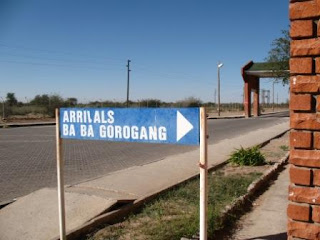

We have plenty of time to get used to travelling in the truck. It's not too bad after you get used to it, rough but we are enthralled by the Kalahari that we are crossing. It's not a sandy empty desert like the Namib, but has lots of small trees and grass cover. As we pass into Botswana the landscape changes, and the number of goats and donkeys steadily increases.
We arrive in Ghanzi, at Tautona Lodge, just before sunset. Into the lodge and find our room is ok, single beds and a tiny bathroom but somewhere clean to sleep. We have a few minutes to clean up then back in the truck to go down to where the backpackers are camped to see some dancing from the Bushmen. They arrive in their 4WD and get changed then dance for us.
 The San, who were formally know as the Bushmen, are indigenous to Botswana (and Namibia) and have lived here for over 30,000 years. It is said that the word San meant ‘wild people who can’t farm’, however historically they didn’t have a collective word for
themselves. Now they call themselves Ncoakhoe meaning ‘red people’. They were nomadic people – primarily hunter gathers, moving to where the food and water could be found. It is estimated that there are 55,000 San people left, with 60% of them living in Botswana and many examples of their cave drawing can be found dotted around.
The trip started really well. The first day in South Africa my debit card was skimmed and my bank account drained of all money then frozen by the credit union. Great start to the holiday but fortunately Michael's account was untouched although he used the same ATM. I still kick myself because I knew something was wrong but i didn't want to offend anyone, so I let myself be scammed. I've learned my lesson!
 Joburg airport is a nightmare. Ostensibly they are improving it but there is construction everywhere, getting through immigration is painfully slow and the only security we saw was a very disinterested police officer at a desk.. unlike other major cities there were none anywhere near the ATMs, which should have set the alarm bells off. However we made it through and went to a really nice B&B in Joburg - they picked us up from the terminal. There is a high fence topped by a multi-strand electric fence and barred windows, back to base security and we're quite glad of it! The headlines in the paper the next morning told if the police breaking a gang who were kidnapping tourists from Joburg airport and murdering them. Maybe I was fortunate that I just had my card hijacked.
We were dropped back at the airport for the 2 hour flight across Botswana to Windhoek, in Namibia, flown by the self-proclaimed 'Captain Fantastic'! He reminded us to check for all personal posesions, as anything left behind would be divided up amongst the crew. LOL.

We stepped down onto the tarmac and it was like something out of another world - the landscape is different, the sky is not as blue as ours but it was a spectacularly beautiful day. We negotiated a price for a cab to take us to out hotel and off we went. It's a fair way out of town and took us about 1/2 an hour to get in. When we got to the hotel we got our first taste of African hotelery! There had been power shedding (strange euphemism - when there is not enough power they turn it off for a few hours...) and so the machine that did the room keys was, of course, not working. The security guard had to come with us and let us into the room, and when we went out later we had to come back and find him to let us back in. High security!! So we went out anyway and cruised up the main street - unfortunately being Sunday almost everything was closed, but we found a few straggling stalls that had obviously formed part of a street market.


Next morning we were picked up by the Nomad truck, and apparently we were supposed to be at a different hotel, where the rest of the people on the trip had stayed, but thankfully they found us. There are only 9 others on the trip, plus a German translator who had left her Germans in Windhoek so was basically the off-sider to the cook for the rest of the trip.
 We set off for the Buitepos border, about a 500km drive, where we enter Botswana. We stopped at Gobabis to get supplies, which gave us our first opportunity to really see an African town. The most fascinating, I thought, were the Herero women. The Herero belong to the Bantu group, wth about 240,000 members alive today. The majority of the Herero live in Namibia, with the remainder living in Botswana and Angola.
Herero women wear very long, flowing Victorian gowns over hooped petticoats and distinctive head dresses. Multiple layers of petticoats made from over 12 metres of material are voluminous. Apparently missionaries who were appalled by the Hereros` semi-nakedness introduced this style of dress in the 1800`s. Now the Hereros continue to wear these heavy garments and it has become their traditional dress. The dresses are generally hand-made by the Herero women, and are an important part of a young lady's "coming of age". It is considered a privilege to be allowed to put on and wear the Herero dress. The hat is supposed to symbolize the horns of the cape buffalo, one of the mightiest animals of southern Africa. The sleeves are designed to billow like an elephant's trunk.


We have plenty of time to get used to travelling in the truck. It's not too bad after you get used to it, rough but we are enthralled by the Kalahari that we are crossing. It's not a sandy empty desert like the Namib, but has lots of small trees and grass cover. As we pass into Botswana the landscape changes, and the number of goats and donkeys steadily increases.
We arrive in Ghanzi, at Tautona Lodge, just before sunset. Into the lodge and find our room is ok, single beds and a tiny bathroom but somewhere clean to sleep. We have a few minutes to clean up then back in the truck to go down to where the backpackers are camped to see some dancing from the Bushmen. They arrive in their 4WD and get changed then dance for us.
 The San, who were formally know as the Bushmen, are indigenous to Botswana (and Namibia) and have lived here for over 30,000 years. It is said that the word San meant ‘wild people who can’t farm’, however historically they didn’t have a collective word for
themselves. Now they call themselves Ncoakhoe meaning ‘red people’. They were nomadic people – primarily hunter gathers, moving to where the food and water could be found. It is estimated that there are 55,000 San people left, with 60% of them living in Botswana and many examples of their cave drawing can be found dotted around.
Saturday, September 29, 2007
Mostar, Bosnia
We managed to get onto a trip to Mostar today - despite being cancelled at 9pm the night before by a travel agent and having to call someone else at about 10... :) Thank you Dubrovnik Travel!
We stopped at a couple of places along the way to Mostar from Dubrovnik. The most interesting was called Pocitelj. It's in the Neretva river valley about 25km from Mostar. It existed in 1444 as a fortress supported by Hungary; Turks took it over in 1471 and it became an important part of the Ottoman Empire. A 17th century enclosing wall still exists. In its heyday, there was in the town an elementary school (mekteb), a secondary theological school (medresa) and also public baths (hammam) and an inn for travelers (han). The town was constructed right into a rocky mountainside overlooking a bend in the Neretva river. Its characteristic buildings are Ottoman style, with stone house, stone pathways and stone roofs. Lots of women and children selling dried and fresh fruit in these cute little papers twists.
Next we drove through the Neretva Valley, sometimes referred to as the "california of Herzegovina". The Neretva Valley is an area where tribes, nations and their armies have fought for dominance since the beginning of time. The trade routes have gone through Neretva Valley since prehistoric time. Those who controlled the valley and its many robbers and pirates could control the trade for all of present day Croatia and Bosnia-Herzegovina. The whole area is covered in little rivers all providing water for the thousands of tangerine trees, other fruit and vegatables, and increasingly grapes.
Into Mostar, where the devastation from the conflict in 1993 is evident everywhere. The original town is Ottoman, developed in the 15th and 16th century then again by the Austro-Hungarians in the 19th century. In the 1990s, most of the old town and the bridge were destroyed by shelling, and the scars can be seen in the empty buildings and the cemetery in which most of the deaths are 1993. It's so far away from Australia - we saw all of this on our tv screens but it's meaningless because we have no similar experiences. Anyway - the bridge was rebuilt using the same stone and the same methods as the original, and when the stones age will probably look like the Old Bridge - at the moment it's still pretty shiny!
The water in the river Neretva is greener than anything I've seen, apparently caused by a high concentration of limestone and very clear water. Sounds like it could be true - it is a very startling green!
We wandered through the Turkish old town, but after the Grand Bazaar in Istanbul most of the offerings looked over priced and a bit tacky. So off back 'home' to Dubrovnick - tomorrow we are off to Korcula - birthplace of Marco Polo!
We stopped at a couple of places along the way to Mostar from Dubrovnik. The most interesting was called Pocitelj. It's in the Neretva river valley about 25km from Mostar. It existed in 1444 as a fortress supported by Hungary; Turks took it over in 1471 and it became an important part of the Ottoman Empire. A 17th century enclosing wall still exists. In its heyday, there was in the town an elementary school (mekteb), a secondary theological school (medresa) and also public baths (hammam) and an inn for travelers (han). The town was constructed right into a rocky mountainside overlooking a bend in the Neretva river. Its characteristic buildings are Ottoman style, with stone house, stone pathways and stone roofs. Lots of women and children selling dried and fresh fruit in these cute little papers twists.
Next we drove through the Neretva Valley, sometimes referred to as the "california of Herzegovina". The Neretva Valley is an area where tribes, nations and their armies have fought for dominance since the beginning of time. The trade routes have gone through Neretva Valley since prehistoric time. Those who controlled the valley and its many robbers and pirates could control the trade for all of present day Croatia and Bosnia-Herzegovina. The whole area is covered in little rivers all providing water for the thousands of tangerine trees, other fruit and vegatables, and increasingly grapes.
Into Mostar, where the devastation from the conflict in 1993 is evident everywhere. The original town is Ottoman, developed in the 15th and 16th century then again by the Austro-Hungarians in the 19th century. In the 1990s, most of the old town and the bridge were destroyed by shelling, and the scars can be seen in the empty buildings and the cemetery in which most of the deaths are 1993. It's so far away from Australia - we saw all of this on our tv screens but it's meaningless because we have no similar experiences. Anyway - the bridge was rebuilt using the same stone and the same methods as the original, and when the stones age will probably look like the Old Bridge - at the moment it's still pretty shiny!
The water in the river Neretva is greener than anything I've seen, apparently caused by a high concentration of limestone and very clear water. Sounds like it could be true - it is a very startling green!
We wandered through the Turkish old town, but after the Grand Bazaar in Istanbul most of the offerings looked over priced and a bit tacky. So off back 'home' to Dubrovnick - tomorrow we are off to Korcula - birthplace of Marco Polo!
Friday, September 28, 2007
Dubrovnik, Croatia
Well we've been here for nearly a week now and I haven't done anything much other than put lots of photos onto the Picasa Web album. So here we go - a description of the old town. I'll attach labels to the photos rather than insert pictures into this post - much easier!
The most recognizable feature of the historic city of Dubrovnik are its intact city walls, which run uninterrupted for 1940 meters encircling the city. This complex structure, one of the most beautiful and strongest for system in the Mediterranean, consists of a series of forts, bastions, casemates, towers and detached forts.
The history of the fortifications goes back to the early Middle Ages. The earliest urban settlement upon the islet of Laus was protected with walls, and the fact that the city was able to resist the Saracens who besieged the city for 15months in the 9th century means that it was fortified well. The city first spread towards the uninhabited eastern part of the islet. The eastern section was included within the defence walls in the 9th and 10th century. When the sea channel separating the city from mainland was filled with earth in 11th century, the city merged with the settlement on land and soon a single wall was built around the area of the present-day city core. The whole city was enclosed in the 13th century, except for the Dominican monastery, which came under their protection not before the 14th century. The average thickness of the wall was 1.5 metres, and it was built of stone and lime. To increase the strength of the walls and ensure better defence, 15 square forts were built in the 14th century.
Extensive work was done on the walls towards the close of the 14th century, at the time of the final liberation from the Venetian supremacy. The design of the walls derives from 14th century, while the definite shape was fixed in the period referred to as the Golden Age of Dubrovnik, from the fall of Constantinople in 1453 until the devastating earthquake of 1667. The main wall on the landside is 4 to 6 metres thick, but narrower on the side facing the sea-1.5 to 3 metres thick. Its height reaches 25 meters in some places. An additional scarp wall as defence against artillery fire protects the wall on the landside. The irregular quadrilateral formed by the walls is protected at four prominent points by strong forts. The strong round Tower Minčeta is to the north, the port is protected by the detached Fortress Revelin in the east and by the big complex of the Fortress of Saint John in the southeast. The western entrance to the city protects the strong and beautiful tower Bokar. Powerful detached Fortress Lovrijenac also protects the western end of the city from danger from the sea and land. In additional to these strong and most prominent fortifications, the city walls are protected additionally by 2 round towers, 12 quadrilateral forts, 5 bastions and 2 corner towers, while the scarp wall is flanked by one large and 9 small semicircular bastions.
We enter through the Pile Gate, which is where the bus drops us off. Outside the gate is a fantastic view of the walls and one of the forts (Bokar), up on a rock outside the city walls. This fort's walls are much thinner on the side afcing the city so that if it was captured by the enemy the town could shell it easily! How's that for forward planning! The drawbridge was raised every night. There are two massive doors through the walls, an exterior door in a Renaissance style and a Gothic interior door topped by the statue of St Blaise, Dubrovnik's patron saint.
Straight ahead is the town's main street, Placa (pronounced "platsa") or Stradun, Dubrovnik's most illustrious feature, with the clock tower at the end.
Along the wide gleaming (limestone) street lined with shops and cafes, all Dubrovnik's processions take place. In front of the Pile Gate entrance is the circular Onofrio Fountain (named after its Neapolitan builder) built in the 15th century and with 16 carved masks, all with water spouts. Unlike the rest of Dalmatia, Dubrovnik citizens were not relegated to capturing rainwater; the fountain was connected by aqueduct with a spring 12km from town.
Opposite is the Franciscan Monastery with the restored sculpture of the Pieta over the entrance door. Inside is the Pharmacy dating from the 14th century and a gorgeous cloister also from the 14th century.
Next to the monastery is the 16th-century St Saviour Church, one of the few Renaissance structures to survive the earthquake of 1667.There are often concerts and exhibitions here.
Orlando's Column on the eastern end of Stradun was carved in 1417 and has been a popular meeting place for almost six centuries!
The Sponza Palace, Dubrovnik's Renaissance highlight is on one side f the square, and houses the State Archives.
Nearby is the ornate St Blaise's church, at the end of Stradun, dedicated to Dubrovnik's patron saint. Inside the lavish 18th-century church is a charming 15th-century statue of St Blaise who holds a scale model of Dubrovnik in his hand.
The Rector's Palace was built in the late 15th century for Dubrovnik's ruler, the elected Rector, who held office for one month on a revolving basis and was not allowed to leave the building during his term.
Across the square is Dubrovnik's baroque Cathedral. Built in the 18th century after an earthquake destroyed the original,the cathedral is still being explored after excavations revealed traces dating back to the 7th century.
The Ploce Gate also exits the city, and near here is the Dominican Monastery with a sober exterior that blends into Dubrovnik's walls. The art collection here centers on Dubrovnik's finest painters, mostly from the 15th and 16th centuries. There's also a lovely cloister dedicated to St Sebastian.
The view from Dubrovnik's walls is a fantastic way to get a feeling for the city. The walls are around 2km long, 25m high and up to 3m thick. As you look down at the town, you can see a patchwork of colours formed by the red-roofs. The shelling of 1991 left gaping holes Dubrovnik's distinctive terra cotta roofs. Some were repaired with tiles from a factory in Slovenia, some came from Agen, France but most were produced in northern Croatia.
The most recognizable feature of the historic city of Dubrovnik are its intact city walls, which run uninterrupted for 1940 meters encircling the city. This complex structure, one of the most beautiful and strongest for system in the Mediterranean, consists of a series of forts, bastions, casemates, towers and detached forts.
The history of the fortifications goes back to the early Middle Ages. The earliest urban settlement upon the islet of Laus was protected with walls, and the fact that the city was able to resist the Saracens who besieged the city for 15months in the 9th century means that it was fortified well. The city first spread towards the uninhabited eastern part of the islet. The eastern section was included within the defence walls in the 9th and 10th century. When the sea channel separating the city from mainland was filled with earth in 11th century, the city merged with the settlement on land and soon a single wall was built around the area of the present-day city core. The whole city was enclosed in the 13th century, except for the Dominican monastery, which came under their protection not before the 14th century. The average thickness of the wall was 1.5 metres, and it was built of stone and lime. To increase the strength of the walls and ensure better defence, 15 square forts were built in the 14th century.
Extensive work was done on the walls towards the close of the 14th century, at the time of the final liberation from the Venetian supremacy. The design of the walls derives from 14th century, while the definite shape was fixed in the period referred to as the Golden Age of Dubrovnik, from the fall of Constantinople in 1453 until the devastating earthquake of 1667. The main wall on the landside is 4 to 6 metres thick, but narrower on the side facing the sea-1.5 to 3 metres thick. Its height reaches 25 meters in some places. An additional scarp wall as defence against artillery fire protects the wall on the landside. The irregular quadrilateral formed by the walls is protected at four prominent points by strong forts. The strong round Tower Minčeta is to the north, the port is protected by the detached Fortress Revelin in the east and by the big complex of the Fortress of Saint John in the southeast. The western entrance to the city protects the strong and beautiful tower Bokar. Powerful detached Fortress Lovrijenac also protects the western end of the city from danger from the sea and land. In additional to these strong and most prominent fortifications, the city walls are protected additionally by 2 round towers, 12 quadrilateral forts, 5 bastions and 2 corner towers, while the scarp wall is flanked by one large and 9 small semicircular bastions.
We enter through the Pile Gate, which is where the bus drops us off. Outside the gate is a fantastic view of the walls and one of the forts (Bokar), up on a rock outside the city walls. This fort's walls are much thinner on the side afcing the city so that if it was captured by the enemy the town could shell it easily! How's that for forward planning! The drawbridge was raised every night. There are two massive doors through the walls, an exterior door in a Renaissance style and a Gothic interior door topped by the statue of St Blaise, Dubrovnik's patron saint.
Straight ahead is the town's main street, Placa (pronounced "platsa") or Stradun, Dubrovnik's most illustrious feature, with the clock tower at the end.
Along the wide gleaming (limestone) street lined with shops and cafes, all Dubrovnik's processions take place. In front of the Pile Gate entrance is the circular Onofrio Fountain (named after its Neapolitan builder) built in the 15th century and with 16 carved masks, all with water spouts. Unlike the rest of Dalmatia, Dubrovnik citizens were not relegated to capturing rainwater; the fountain was connected by aqueduct with a spring 12km from town.
Opposite is the Franciscan Monastery with the restored sculpture of the Pieta over the entrance door. Inside is the Pharmacy dating from the 14th century and a gorgeous cloister also from the 14th century.
Next to the monastery is the 16th-century St Saviour Church, one of the few Renaissance structures to survive the earthquake of 1667.There are often concerts and exhibitions here.
Orlando's Column on the eastern end of Stradun was carved in 1417 and has been a popular meeting place for almost six centuries!
The Sponza Palace, Dubrovnik's Renaissance highlight is on one side f the square, and houses the State Archives.
Nearby is the ornate St Blaise's church, at the end of Stradun, dedicated to Dubrovnik's patron saint. Inside the lavish 18th-century church is a charming 15th-century statue of St Blaise who holds a scale model of Dubrovnik in his hand.
The Rector's Palace was built in the late 15th century for Dubrovnik's ruler, the elected Rector, who held office for one month on a revolving basis and was not allowed to leave the building during his term.
Across the square is Dubrovnik's baroque Cathedral. Built in the 18th century after an earthquake destroyed the original,the cathedral is still being explored after excavations revealed traces dating back to the 7th century.
The Ploce Gate also exits the city, and near here is the Dominican Monastery with a sober exterior that blends into Dubrovnik's walls. The art collection here centers on Dubrovnik's finest painters, mostly from the 15th and 16th centuries. There's also a lovely cloister dedicated to St Sebastian.
The view from Dubrovnik's walls is a fantastic way to get a feeling for the city. The walls are around 2km long, 25m high and up to 3m thick. As you look down at the town, you can see a patchwork of colours formed by the red-roofs. The shelling of 1991 left gaping holes Dubrovnik's distinctive terra cotta roofs. Some were repaired with tiles from a factory in Slovenia, some came from Agen, France but most were produced in northern Croatia.
Thursday, April 05, 2007
Jess' Graduation!
Jessica Graduated today with a Bachelor of Social Science degree. We are all very proud of her and her achievement!!!
 |
| Jessica's Graduation |
Sunday, March 11, 2007
Hannah's first birthday
mmm.. aren't first birthdays fun!
Today was my beautiful neice Hannah's first one, and what fun she had! Some photos in the albums...
Today was my beautiful neice Hannah's first one, and what fun she had! Some photos in the albums...
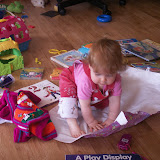 |
| Hannah's Bithday |
Thursday, March 08, 2007
Acapulco
I know I have been very tardy in getting anything up here about Acapulco, but here it is!
We went to the Estrella D'Oro station on Saturday morning and I successfully, in Spanish, bought three return tickets to Acapulco - first class going down and in the special Diamante bus coming home! Ta Da!!!
We headed off on a very comfortable and uncrowded bus, and some 6 hours and innumerable stops at toll booths later, arrived in sunny Acapulco. The scenery on the way was nothing short of spectacular, and worth the trip by bus just to get to see sme more of Mexico out of the city.
In Acapulco, taxis were plentiful, but seemed to be very downmarket compared to DF.... lots and lots of VWs everywhere! We stayed at the Boca Chica Hotel, as recommended by the Lonely Planet Guide. This is not your high rise touristy hotel, and while it certainly lacked a little in the way of conveniences (no internet - GASP!), dodgy lighting and beds out of the Ark, it made up for these shortcomings by being quiet, green and lacking in tourists and spring breakers!
The first night we went to see the cliff divers... La Quebrada. MMM.. well maybe we were expecting something a little more spectacular - even though it was dark they didn't jump with the lit torches! We were very underwhelmed, although the ride there and back in a VW nearly took out breath away!
Other than this, we went to see the Fort and museum. For more than 250 years (1565-1815), trade between Spain (and thus a large part of Europe) and the 'Orient' was funneled through the port of Acapulco. Fuerte San Diego was built to protect the shipping and trade from English and Dutch pirates. The museum is really well done, and being Sunday, was free! Anyway after that we wandered to the Mask Museum, then down to the Artesans Market where we were badgered into buying things we didn't really want (now there's a surprise!) and then went back to the hotel for beer and swimming! At least the air conditioners in the rooms worked well, so we could cool down a bit. We also moved from the side with a view overlooking the island to the side with a view over the beach, as the room was bigger. The fold out bedllooked like it hadn't been used for a verrrry long time, so we skipped that and Jess and I bunked in together. Not ideal but only for a couple of days. The new side to the hotel gave us a great view over a family beach, where we sat for a couple of hours just watching the comings and goings.
The next few days we just took it pretty easy - swimming in the ocean until the jellyfish and the oil slick came in, and then into the pool!
We went to the Estrella D'Oro station on Saturday morning and I successfully, in Spanish, bought three return tickets to Acapulco - first class going down and in the special Diamante bus coming home! Ta Da!!!
We headed off on a very comfortable and uncrowded bus, and some 6 hours and innumerable stops at toll booths later, arrived in sunny Acapulco. The scenery on the way was nothing short of spectacular, and worth the trip by bus just to get to see sme more of Mexico out of the city.
In Acapulco, taxis were plentiful, but seemed to be very downmarket compared to DF.... lots and lots of VWs everywhere! We stayed at the Boca Chica Hotel, as recommended by the Lonely Planet Guide. This is not your high rise touristy hotel, and while it certainly lacked a little in the way of conveniences (no internet - GASP!), dodgy lighting and beds out of the Ark, it made up for these shortcomings by being quiet, green and lacking in tourists and spring breakers!
The first night we went to see the cliff divers... La Quebrada. MMM.. well maybe we were expecting something a little more spectacular - even though it was dark they didn't jump with the lit torches! We were very underwhelmed, although the ride there and back in a VW nearly took out breath away!
Other than this, we went to see the Fort and museum. For more than 250 years (1565-1815), trade between Spain (and thus a large part of Europe) and the 'Orient' was funneled through the port of Acapulco. Fuerte San Diego was built to protect the shipping and trade from English and Dutch pirates. The museum is really well done, and being Sunday, was free! Anyway after that we wandered to the Mask Museum, then down to the Artesans Market where we were badgered into buying things we didn't really want (now there's a surprise!) and then went back to the hotel for beer and swimming! At least the air conditioners in the rooms worked well, so we could cool down a bit. We also moved from the side with a view overlooking the island to the side with a view over the beach, as the room was bigger. The fold out bedllooked like it hadn't been used for a verrrry long time, so we skipped that and Jess and I bunked in together. Not ideal but only for a couple of days. The new side to the hotel gave us a great view over a family beach, where we sat for a couple of hours just watching the comings and goings.
The next few days we just took it pretty easy - swimming in the ocean until the jellyfish and the oil slick came in, and then into the pool!
 |
| Acapulco |
Thursday, March 01, 2007
Mexico City on foot
On Monday, we walked down to the Zocalo, via the LatinAmerica building. Now that I have felt several earth tremors I can appreciate the fact that this building was built with earthquakes in mind! More later but photos here...
Sunday, February 25, 2007
Teotihuacán
Next day we organised for 16 PISA people to go to the pyramids at Teotihuacan, the City of the Gods. Our driver from Thursday and a couple of his mates took us out there for a very reasonable price, so we drove out through kilometre after kilometre of suburbs until we got to the pyramids.
This is the site of the Sun and the Moon pyramids, and was Mexico's biggest ancient city and capital of the largest pre-hispanic empire. The city was developed in the early part of the first century AD, and the pyramid of the Sun was built by 150AD. At 2300m above sea level, it was always going to be a challenge to climb , but we all did it! Daniel then climbed to the top of the Pyramid of the Moon - twice - because on the first climb there was no one at the top that he knew to take his photo, so he came down and went back up!
The Avenue of the Dead was the main street of Teotihuacan. It ran for more than 2.5 km, beginning at the Moon Plaza to the north and extending beyond the Ciudadela and the Great Compound complexes to the south.
The avenue divided the city into two sections. Apartment compounds with pyramidal constructions were arranged on both sides of the avenue, often symetrically and sharing the same orientation. This highly planned city-layout suggests that the avenue may have been planned since its earliest phases of urbanization.
The main sector of the avenue was evidently the section between the Moon Pyramid and the Rio San Juan channel. This part of the avenue was lined with long platforms. Access to flanking residential zones was confined to masonry stairways with balustrades. The width of the avenue varies significantly between different sections, ranging from 40 to 95 metres. A large long channel under the floor of the avenue gathered rain water from neighboring architectural units and drained it into Rio San Juan.
As originally built, the Sun Pyramid was approximately 215 by 215 m at the base, and about 63 m high. It was significantly enlarged at least twice in later periods, resulting in a final size of 225 m along each side. The pyramid was located on the east side of the Avenue of the Dead in the northern half of the city. If the area of monumental construction between the Moon Pyramid and the San Juan Canal is regarded as the central zone of the city, the Sun Pyramid is located at its middle. In addition to its geographic centrality, the importance of the pyramid is indicated by a cave located under the structure, which was used for ritual purposes.
The Moon Pyramid is located at the northern end of the Avenue of the Dead, which was the main axis of the city. The pyramid, facing south, was built as the principal monument of the Moon Pyramid complex. The five-tiered platform was attached to the front of the Moon Pyramid. It is said that the present pyramid has interior structures within it.
The consolidated structures around the Moon Plaza demonstrate that the city was highly planned symmetrically and was integrated into the local geography. This may be realized by standing on the center line of the Avenue of the Dead, namely on the main axis of the city. The top of mountain Cerro Gordo dominating the background of the Moon Pyramid exactly coincides at a certain point of the avenue with the top of the pyramid; a pan-Mesoamerican notion that the pyramid represents a sacred mountain seems to have been an integral element of the city plan. The Avenue of the Dead begins at the Moon Plaza, which was surrounded by 15 pyramidal structures including the Moon Pyramid. The Quetzalpapalotl Palace lies immediately to the southwest of the Moon Plaza. Like the Main Plaza in the Ciudadela, the Moon Plaza seem to have been one of the main ritual precincts of the city.
This is the site of the Sun and the Moon pyramids, and was Mexico's biggest ancient city and capital of the largest pre-hispanic empire. The city was developed in the early part of the first century AD, and the pyramid of the Sun was built by 150AD. At 2300m above sea level, it was always going to be a challenge to climb , but we all did it! Daniel then climbed to the top of the Pyramid of the Moon - twice - because on the first climb there was no one at the top that he knew to take his photo, so he came down and went back up!
The Avenue of the Dead was the main street of Teotihuacan. It ran for more than 2.5 km, beginning at the Moon Plaza to the north and extending beyond the Ciudadela and the Great Compound complexes to the south.
The avenue divided the city into two sections. Apartment compounds with pyramidal constructions were arranged on both sides of the avenue, often symetrically and sharing the same orientation. This highly planned city-layout suggests that the avenue may have been planned since its earliest phases of urbanization.
The main sector of the avenue was evidently the section between the Moon Pyramid and the Rio San Juan channel. This part of the avenue was lined with long platforms. Access to flanking residential zones was confined to masonry stairways with balustrades. The width of the avenue varies significantly between different sections, ranging from 40 to 95 metres. A large long channel under the floor of the avenue gathered rain water from neighboring architectural units and drained it into Rio San Juan.
As originally built, the Sun Pyramid was approximately 215 by 215 m at the base, and about 63 m high. It was significantly enlarged at least twice in later periods, resulting in a final size of 225 m along each side. The pyramid was located on the east side of the Avenue of the Dead in the northern half of the city. If the area of monumental construction between the Moon Pyramid and the San Juan Canal is regarded as the central zone of the city, the Sun Pyramid is located at its middle. In addition to its geographic centrality, the importance of the pyramid is indicated by a cave located under the structure, which was used for ritual purposes.
The Moon Pyramid is located at the northern end of the Avenue of the Dead, which was the main axis of the city. The pyramid, facing south, was built as the principal monument of the Moon Pyramid complex. The five-tiered platform was attached to the front of the Moon Pyramid. It is said that the present pyramid has interior structures within it.
The consolidated structures around the Moon Plaza demonstrate that the city was highly planned symmetrically and was integrated into the local geography. This may be realized by standing on the center line of the Avenue of the Dead, namely on the main axis of the city. The top of mountain Cerro Gordo dominating the background of the Moon Pyramid exactly coincides at a certain point of the avenue with the top of the pyramid; a pan-Mesoamerican notion that the pyramid represents a sacred mountain seems to have been an integral element of the city plan. The Avenue of the Dead begins at the Moon Plaza, which was surrounded by 15 pyramidal structures including the Moon Pyramid. The Quetzalpapalotl Palace lies immediately to the southwest of the Moon Plaza. Like the Main Plaza in the Ciudadela, the Moon Plaza seem to have been one of the main ritual precincts of the city.
Friday, February 23, 2007
Mexico City - first impressions
We flew into Mexico City late on Thursday night. From a distance you could see the lights of this enormous city, and as we got closer it became obvious just how big it was. I can't even remember clearing customs and immigration now, but I guess we did!
Found the hotel, in the Zona Rosa district, which at night is teeming with activity - not always savoury - have seen quite a few prostitutes of both genders! However it's not that far from downtown, and has its own charm.
First album of photos on the picasa web page is sights around Mexico City.
On the first day we hired a taxi driver who drove us around all day for 800 pesos for the four of us - about $20 each. He took us first to the main bullfighting ring in Mexico City - the Monumental Plaza Bull Ring, which holds about 110, 000 people and has fights on a Saturday. It looked hot and uncomfortable, and for those of us with other than tiny derrieres, the concrete seats looked narrow and constricting!!! Next stop was the Frida Kahlo house in Coyoacan. None of us knew much about Frida Kahlo before we went there - only what we had remembered for those of us who'd seen the Selma Hayek film! Frida Kahlo and Diego Rivera lived in this house during part of their marriage; they had a stormy relationship and divorced but came back together throughout their lives. They were both communists, and their paintings are passionate and strong and evocative of their times and lives. For example Frida had an affair with Trotsky. There's a lot more info here. The print I bought is shown and described here.
After this we went to Xochimilco...
Today this area, once on the edge of Mexico City, has been engulfed by the city. There are miles of these canals of which only 14 km, lined with farm homes and trees, dominated by the ahuejote, are navigable. The Gardens, besides still producing flowers, fruits and vegetables, have become a favourite spot where both locals and tourists come for a few hours to relax in the canals and enjoy their market culture.
Our trajinera (flat boat), like the 2,000 others that daily ply these canals for both work and pleasure, glided over the water with ease. Smaller trajineras, called chalupas came up alongside and continuously harangued us, offering drinks, food, handicrafts and much more - seemingly everything under the sun was for sale on these floating markets. Some were virtually floating kitchens, which offered a complete hot meal. Very touristy and yet not - there were many locals having parties on these boats, mariachi bands playing - it was all very festive and relaxing.
We went around the next day on the Turibus, which provided us with an overview of the main sights here. We also all got sunburnt, underestimating the strength of the sun as we sat in traffic for hour after hour after hour!
In the Zocalo we went to the archaelogical site of Tenochtitlan.
Found the hotel, in the Zona Rosa district, which at night is teeming with activity - not always savoury - have seen quite a few prostitutes of both genders! However it's not that far from downtown, and has its own charm.
First album of photos on the picasa web page is sights around Mexico City.
On the first day we hired a taxi driver who drove us around all day for 800 pesos for the four of us - about $20 each. He took us first to the main bullfighting ring in Mexico City - the Monumental Plaza Bull Ring, which holds about 110, 000 people and has fights on a Saturday. It looked hot and uncomfortable, and for those of us with other than tiny derrieres, the concrete seats looked narrow and constricting!!! Next stop was the Frida Kahlo house in Coyoacan. None of us knew much about Frida Kahlo before we went there - only what we had remembered for those of us who'd seen the Selma Hayek film! Frida Kahlo and Diego Rivera lived in this house during part of their marriage; they had a stormy relationship and divorced but came back together throughout their lives. They were both communists, and their paintings are passionate and strong and evocative of their times and lives. For example Frida had an affair with Trotsky. There's a lot more info here. The print I bought is shown and described here.
After this we went to Xochimilco...
In pre-Hispanic Mexico , in the valley where Mexico City stands was a lake called Lago Texcoco, which now has long been drained. The Aztecs, long before the Spanish came, dug a series of canals around the edge of the lake, and the mud they dug was heaped on the earth around the canals or on anchored reeds atop the water. These plots of land, appeared like floating islands called chinampas - hence, their name ‘floating gardens’.
To maintain soil fertility, farmers annually scraped muck from the canal bottom and applied decaying aquatic vegetation to the islands to prepare seed beds. The gardens became one of the most productive farming systems ever developed. By the time the Conquistadors came, the area of Xochimilco had become a rich agricultural district where many of the city's flowers, fruits and vegetables were grown.Today this area, once on the edge of Mexico City, has been engulfed by the city. There are miles of these canals of which only 14 km, lined with farm homes and trees, dominated by the ahuejote, are navigable. The Gardens, besides still producing flowers, fruits and vegetables, have become a favourite spot where both locals and tourists come for a few hours to relax in the canals and enjoy their market culture.
Our trajinera (flat boat), like the 2,000 others that daily ply these canals for both work and pleasure, glided over the water with ease. Smaller trajineras, called chalupas came up alongside and continuously harangued us, offering drinks, food, handicrafts and much more - seemingly everything under the sun was for sale on these floating markets. Some were virtually floating kitchens, which offered a complete hot meal. Very touristy and yet not - there were many locals having parties on these boats, mariachi bands playing - it was all very festive and relaxing.
We went around the next day on the Turibus, which provided us with an overview of the main sights here. We also all got sunburnt, underestimating the strength of the sun as we sat in traffic for hour after hour after hour!
In the Zocalo we went to the archaelogical site of Tenochtitlan.
The Aztecs built their capital city, called Tenochtitlan, in the center of enormous Lake Texcoco. The Aztecs believed they were the “chosen people” of Huitzilopochtli and did everything that he desired of them. During the fourteenth century, Huitzilopochtli told the Aztec chieftain that their new homeland would be on the island in Lake Toxcoco, and when they reached the island they were to look for an eagle eating a snake perched on a cactus growing from a rock or cave surrounded by water. This would be the location where they were to build their city and honor him. They found this location and began to build their city around the year 1325 AD.
The city of Tenochtitlan continued to grow, having an estimated population of 200,000. The city grew to a point where there was no more room for expansion on the island and they were forced to move out into the lake areas. The agricultural portion of this expansion was successful because of the invention of the chinampas or floating gardens. The floating gardens were constructed by bunching twigs together then stacking mud on top of the twigs. They were not anchored at first and could be towed until the plants roots anchored into the lake floor.
The Aztecs connected the island to the mainland by three causeways that ran next to dikes that were built to keep the fresh water of Lake Texcoco separate from other salty lakes of the area. The dikes also protected the agricultural chinampas. Canals ran between the chinampas; they were used to convey traffic through the city, including to and from the market of Tlatelolco.
The city flourished until the year 1521 when Hernandez Cortes and his Spanish army invaded and captured the city. The Spanish also had two other advantages: a lot of tactical skills on behalf of Cortes and smallpox, which devastated the Aztec population. After he defeated the Aztecs, Cortes destroyed most of the buildings that they had built and constructed the new Spanish city on top of the ruins, even using many of the original Aztec building materials in the new construction. He built his home on top of Montezuma’s palace and his cathedral on top of the Aztec temple. After a battle in 1692 the Spanish destroyed most of the art of the Aztecs in the name of Christianity. More info from Wikipedia here.
Subscribe to:
Posts (Atom)